Karte_Niedersaechsisches_Bergland.jpg
Size of this preview:
800 × 545 pixels
.
Other resolutions:
320 × 218 pixels
|
640 × 436 pixels
|
1,024 × 697 pixels
|
1,420 × 967 pixels
.
Summary
| Description |
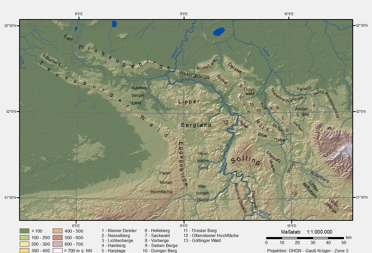
Karte des Niedersächsischen Berglandes (Lower Saxony mountain region). Datengrundlage:
Projektion/Koordinaten:
|
| Date | 6 January 2006 (original upload date) |
| Source | No machine-readable source provided. Own work assumed (based on copyright claims). |
| Author | No machine-readable author provided. Langläufer assumed (based on copyright claims). |
Andere Versionen
Same picture without text and frame (available only in German Wikipedia)
Licensing
|
|
I, the copyright holder of this work, release this work into the
public domain
. This applies worldwide.
In some countries this may not be legally possible; if so: I grant anyone the right to use this work for any purpose , without any conditions, unless such conditions are required by law. |