Kaukasus.jpg

Size of this preview:
776 × 600 pixels
.
Other resolutions:
311 × 240 pixels
|
621 × 480 pixels
|
994 × 768 pixels
|
1,280 × 989 pixels
|
2,560 × 1,978 pixels
|
4,400 × 3,400 pixels
.
Ḝ== Summary ==
| Description |
Deutsch
:
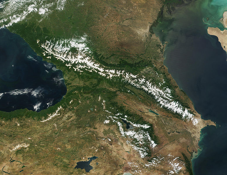
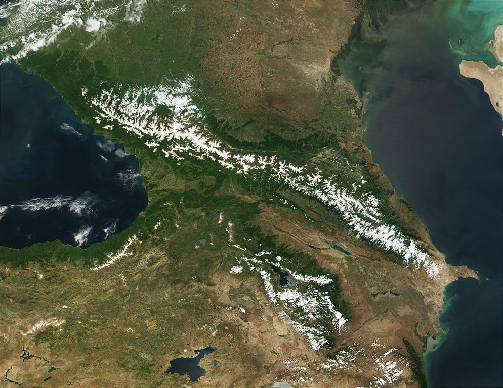
Satellitenaufnahme des Kaukasus von NASAs Visible Earth
English
:
Satellite image of the Caucasus, from NASA’s Visible Earth
|
| Date | |
| Source | http://visibleearth.nasa.gov/view_rec.php?id=1939 |
| Author | NASA/MODIS - Jacques Descloitres, MODIS Land Rapid Response Team |
|
Permission
( Reusing this file ) |
Public Domain |
Licensing
|
|
This file is in the public domain in the United States because it was solely created by NASA . NASA copyright policy states that "NASA material is not protected by copyright unless noted ". (See Template:PD-USGov , NASA copyright policy page or JPL Image Use Policy .) |
|

|
Warnings:
|
Version history
| date/time | username | edit summary |
|---|---|---|
| 05:58, 4. Feb 2006 | de:Benutzer:Denniss | |
| 00:36, 23. Dez 2005 | de:Benutzer:Zwobot | (Bot: ersetze Flaggen durch SVG-Versionen) |
| 11:13, 12. Feb 2005 | de:Benutzer:ChrisM | (PD-Lizenz) |
| 16:27, 7. Sep 2004 | de:Benutzer:80.78.231.68 | |
| 16:26, 7. Sep 2004 | de:Benutzer:80.78.231.68 | |
| 20:43, 30. Jul 2004 | de:Benutzer:ChrisM | (Beschreibung) |
| 20:42, 30. Jul 2004 | de:Benutzer:ChrisM |
Original upload log
Legende: (Aktuell) = dies ist das aktuelle Bild, (Löschen) = lösche diese alte Version, (Zurücksetzen) = verwende wieder diese alte Version.
- (Löschen) (Aktuell) 20:42, 30. Jul 2004 . . de:Benutzer:ChrisM ChrisM ( de:Benutzer_Diskussion:ChrisM Diskussion) . . 1100 x 850 (177902 Byte)