Khazar_map1.PNG

Size of this preview:
800 × 504 pixels
.
Other resolutions:
320 × 202 pixels
|
640 × 403 pixels
|
939 × 592 pixels
.
Summary
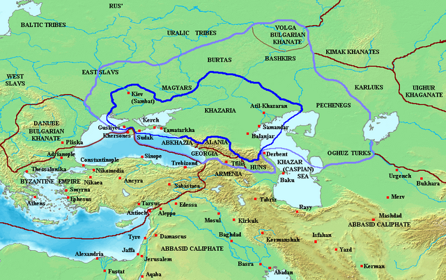
Map of the Khazar Khaganate and surrounding states, c. 820 CE. Area of direct Khazar control shown in dark blue, sphere of influence in purple. Other boundaries shown in dark red.
Made by User:Briangotts
Licensing
|
|
This file is licensed under the Creative Commons Attribution-Share Alike 3.0 Unported license. Subject to disclaimers . | |
|
||
| This licensing tag was added to this file as part of the GFDL licensing update . |

|
Permission is granted to copy, distribute and/or modify this document under the terms of the GNU Free Documentation License , Version 1.2 or any later version published by the Free Software Foundation ; with no Invariant Sections, no Front-Cover Texts, and no Back-Cover Texts. A copy of the license is included in the section entitled GNU Free Documentation License . Subject to disclaimers . |