King_Fahd_causeway_satellite.png

Size of this preview:
800 × 527 pixels
.
Other resolutions:
320 × 211 pixels
|
640 × 422 pixels
|
992 × 654 pixels
.
Summary
| Description |
English:
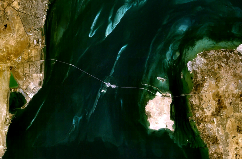
Satellite image of the
King Fahd Causeway
, linking Saudi Arabia (left) and Bahrain (right).
|
| Date | 21 March 2006 (original upload date) |
| Source | NASA World Wind |
| Author | Roke (original uploader) |
Licensing
|
|
This image is in the
public domain
because it is a screenshot from
NASA
’s globe software
World Wind
using a public domain layer, such as Blue Marble, MODIS, Landsat, SRTM, USGS or GLOBE.
|

|