Klamath_Mountains_map.gif
Size of this preview:
451 × 599 pixels
.
Other resolutions:
181 × 240 pixels
|
515 × 684 pixels
.
Summary
| Description |
English:
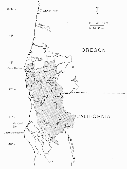
Map of the
Klamath Mountains
Geologic Province (shaded).
|
| Date | (original creation) |
| Source | [1] |
| Author | U.S. Geological Survey, California Division of Mines and Geology and NOAA, Northwest Fisheries Science Center |
|
Permission
( Reusing this file ) |
NOAA source credits map to: "Irwin, W. P. 1966. Geology of the Klamath Mountains Province. In E. H. Bailey (editor), Geology of northern California, p. 19-38. U.S. Geological Survey, California Division of Mines and Geology, Bulletin 190." [2] |
Licensing
|
|
This image is in the
public domain
in the United States because it only contains materials that originally came from the
United States Geological Survey
, an agency of the
United States Department of the Interior
. For more information, see
the official USGS copyright policy
.
|
|