Koppelpoort_Amersfoort_Cropped.jpg

Size of this preview:
800 × 388 pixels
.
Other resolutions:
320 × 155 pixels
|
640 × 310 pixels
|
1,024 × 496 pixels
|
1,280 × 620 pixels
|
3,761 × 1,823 pixels
.
Summary
| Description | See the original image |
| Date | |
| Source | |
| Author | Bert |
| Other versions |

|
| Camera location |
|
View this and other nearby images on: OpenStreetMap |
|
|---|
Licensing
This file is licensed under the
Creative Commons
Attribution 2.0 Generic
license.
-
You are free:
- to share – to copy, distribute and transmit the work
- to remix – to adapt the work
-
Under the following conditions:
- attribution – You must give appropriate credit, provide a link to the license, and indicate if changes were made. You may do so in any reasonable manner, but not in any way that suggests the licensor endorses you or your use.
Assessment
|

|
|
This image was selected as
picture of the day
on Wikimedia Commons for
10 September 2011
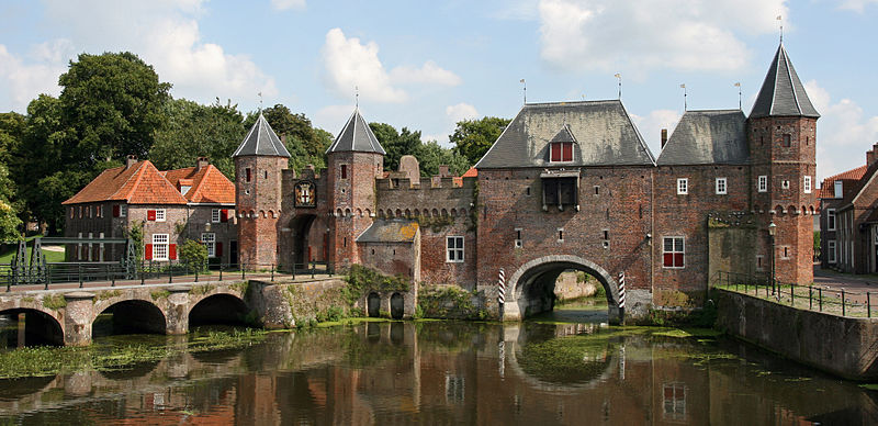
. It was captioned as follows:
Other languages:
Eesti
:
Koppelpoorti värav Hollandis
Amersfoortis
.
Français
:
Le
Koppelpoort
à
Amersfoort
, dans les Pays-Bas.
Українська
:
Міські ворота
Копелпорт
(нід.
Koppelpoort — З'єднані ворота
) в
Амерсфорті
,
Нідерланди
中文
:
荷兰
阿默斯福特
城门
|

|
This image has been assessed under the valued image criteria and is considered the most valued image on Commons within the scope: Koppelpoort . You can see its nomination here . |