Koppen-Geiger_Map_Somaliland_present.svg

Size of this PNG preview of this SVG file:
719 × 350 pixels
.
Other resolutions:
320 × 156 pixels
|
640 × 312 pixels
|
1,024 × 498 pixels
|
1,280 × 623 pixels
|
2,560 × 1,246 pixels
.
Summary
| Description |
English:
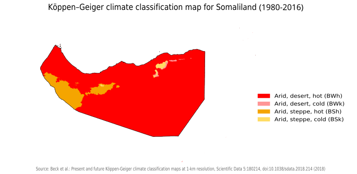
Köppen–Geiger climate classification map for Somaliland
|
| Date | |
| Source | "Present and future Köppen-Geiger climate classification maps at 1-km resolution". Nature Scientific Data . DOI : 10.1038/sdata.2018.214 . |
| Author | Beck, H.E., Zimmermann, N. E., McVicar, T. R., Vergopolan, N., Berg, A., & Wood, E. F. |
Licensing
I, the copyright holder of this work, hereby publish it under the following license:
This file is licensed under the
Creative Commons
Attribution-Share Alike 4.0 International
license.
-
You are free:
- to share – to copy, distribute and transmit the work
- to remix – to adapt the work
-
Under the following conditions:
- attribution – You must give appropriate credit, provide a link to the license, and indicate if changes were made. You may do so in any reasonable manner, but not in any way that suggests the licensor endorses you or your use.
- share alike – If you remix, transform, or build upon the material, you must distribute your contributions under the same or compatible license as the original.
| Camera location |
|
View this and other nearby images on: OpenStreetMap |
|
|---|