Korea_demilitarized_zone_map_-_1969.jpg

Size of this preview:
800 × 225 pixels
.
Other resolutions:
320 × 90 pixels
|
640 × 180 pixels
|
1,024 × 288 pixels
|
1,280 × 360 pixels
|
2,560 × 721 pixels
|
11,456 × 3,226 pixels
.
| Description |
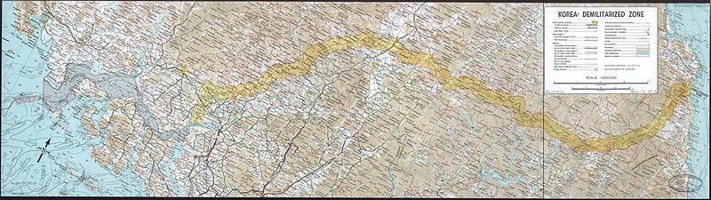
English:
A map of the Korean demilitarized zone (DMZ), produced by the CIA in 1969.
|
||||||
| Date | |||||||
| Source |
Library of Congress
|
||||||
| Author | Central Intelligence Agency | ||||||
|
Permission
( Reusing this file ) |
|
||||||
