Kushanshas-Hepthalites_565ad.jpg

|
This
historical map
image could be re-created
using
vector graphics
as an
SVG
file
. This has several advantages; see
Commons:Media for cleanup
for more information. If an SVG form of this image is available, please upload it and afterwards replace this template with
{{

vector version available

|

new image name

}}
.
It is recommended to name the SVG file “Kushanshas-Hepthalites 565ad.svg”—then the template Vector version available (or Vva ) does not need the new image name parameter. |


Summary
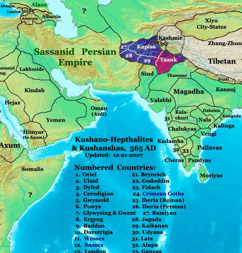
| Description | The Kushano-Hephthalite Kingdoms in 565 AD. |
| Date | |
| Source | Own work |
| Author | Thomas Lessman ( Contact! ) |
|
Permission
( Reusing this file ) |
I, the copyright holder of this work, hereby publish it under the following license:
This file is licensed under the
Creative Commons
Attribution-Share Alike 3.0 Unported
license.
|
| Other versions | see below |
Map Summary

Original Source URL:
http://www.thomaslessman.com/History/images/East-Hem_565ad.jpg
This map is a zoomed-in version of Thomas Lessman's map of the
East-Hem_565ad.jpg
(also available at
www.WorldHistoryMaps.info
).
The highlighted areas represent the surviving
Kushano-Hephthalite Kingdoms
in 565 AD(after the destruction of the Hephthalite Khanate by Persian and Turkish forces).
Map Source References
Remember, sources often conflict with each other
. This map is only as accurate as the information that is available to me.
To report any errors
or to help further this work, please
click here
, or email Thomas Lessman at [email protected]
References for information contained in this map:
Other Maps by Thomas Lessman
|
Maps of the eastern hemisphere showing history
Bold dates are available on Wikimedia
or Wikipedia.
|
||
| Primeval | ||
|
|
||
|
Ancient
|
·|
600 BC
|
550 BC
|
527 BC
|
500 BC
|
400 BC
|
·|
1 AD
|
50 AD
|
100 AD
|
200 AD
|
300 AD
|
|
|
| Medieval |
·|
500 AD
|
565 AD
|
600 AD
|
700 AD
|
|
|
| Modern |
·|
1500 AD
|
·
*
For historical maps of the whole world,
|
|