Kyrgyzstan_Topography.png

Size of this preview:
800 × 476 pixels
.
Other resolutions:
320 × 190 pixels
|
640 × 381 pixels
|
1,024 × 610 pixels
|
1,705 × 1,015 pixels
.
Summary
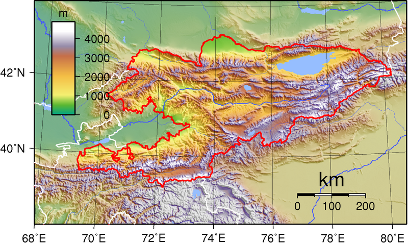
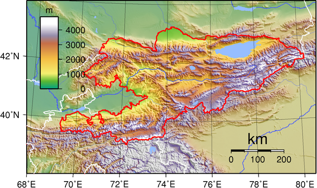
| Description | Topographic map of Kyrgyzstan. Created with GMT from public domain SRT data. |
| Date | Unknown date |
| Source | Own work |
| Author | Sadalmelik |
Licensing
|
|
This work has been released into the
public domain
by its author,
I,
Sadalmelik
. This applies worldwide.
In some countries this may not be legally possible; if so: I, Sadalmelik grants anyone the right to use this work for any purpose , without any conditions, unless such conditions are required by law. |