Le_Mont_Tahat.jpeg

Size of this preview:
800 × 528 pixels
.
Other resolutions:
320 × 211 pixels
|
640 × 423 pixels
|
1,024 × 676 pixels
.
Summary
| Description |
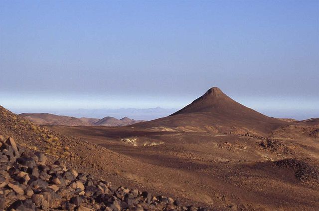
Français :
Le mont Tahat (3003 m) au sud ouest du Massif du Hoggar, sud de l'Algérie
|
| Date | Fin 2004 (original upload date is 2007-10-06) |
| Source | Transferred from fr.wikipedia to Commons. |
| Author | Maurice, cap sur le Hoggar, de l'Atakor à la Taessa |
Licensing
This file is licensed under the
Creative Commons
Attribution-Share Alike 2.5 Generic
license.
-
You are free:
- to share – to copy, distribute and transmit the work
- to remix – to adapt the work
-
Under the following conditions:
- attribution – You must give appropriate credit, provide a link to the license, and indicate if changes were made. You may do so in any reasonable manner, but not in any way that suggests the licensor endorses you or your use.
- share alike – If you remix, transform, or build upon the material, you must distribute your contributions under the same or compatible license as the original.

|
Permission is granted to copy, distribute and/or modify this document under the terms of the GNU Free Documentation License , Version 1.2 or any later version published by the Free Software Foundation ; with no Invariant Sections, no Front-Cover Texts, and no Back-Cover Texts. A copy of the license is included in the section entitled GNU Free Documentation License . |
|
|
This file is licensed under the Creative Commons Attribution-Share Alike 3.0 Unported license. | |
|
||
| This licensing tag was added to this file as part of the GFDL licensing update . |
Original upload log
The original description page was
here
. All following user names refer to fr.wikipedia.
- 2007-10-06 01:16 Lecarteldz 1024×676×8 (60164 bytes) {{GFDL}}