Liechtenstein_-_Gemeinden_mit_Exklaven.png

Size of this preview:
369 × 599 pixels
.
Other resolutions:
148 × 240 pixels
|
296 × 480 pixels
|
473 × 768 pixels
|
631 × 1,024 pixels
|
1,359 × 2,206 pixels
.
| Description |
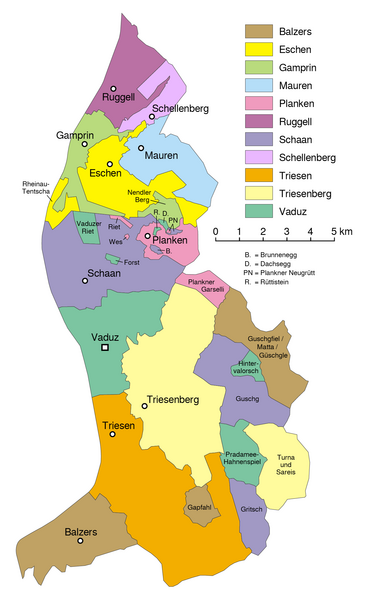
Deutsch:
Gemeindekarte von Liechtenstein
English:
Map of the municipalities of Liechtenstein
فارسی:
نقشه شهرداریهای لیختن اشتاین
|
|||
| Date | see file history | |||
| Source | File:Liechtenstein-admin.png | |||
| Author | Maximilian Dörrbecker ( Chumwa ) | |||
|
Permission
( Reusing this file ) |
I, the copyright holder of this work, hereby publish it under the following license:
This file is licensed under the
Creative Commons
Attribution 2.5 Generic
license.
Sie dürfen das Bild zu den folgenden Bedingungen nutzen:
|
|||
| Other versions |
|


|
This
locator map
image could be re-created
using
vector graphics
as an
SVG
file
. This has several advantages; see
Commons:Media for cleanup
for more information. If an SVG form of this image is available, please upload it and afterwards replace this template with
{{

vector version available

|

new image name

}}
.
It is recommended to name the SVG file “Liechtenstein - Gemeinden mit Exklaven.svg”—then the template Vector version available (or Vva ) does not need the new image name parameter. |