Litorale_1.png
Size of this preview:
611 × 599 pixels
.
Other resolutions:
245 × 240 pixels
|
489 × 480 pixels
|
783 × 768 pixels
|
1,044 × 1,024 pixels
|
2,264 × 2,221 pixels
.
Summary
| Description |
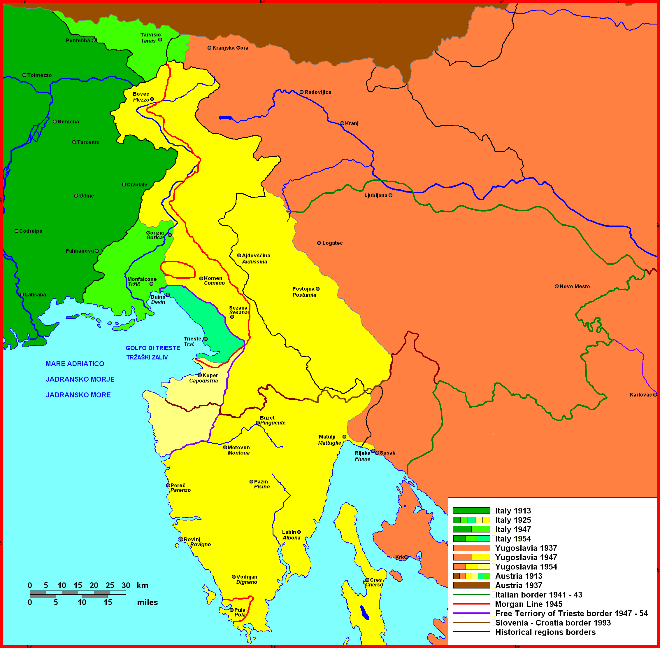
English:
Istrian Littoral, map of 20th century history
Čeština:
Přímoří, mapa dějin 20. století
|
| Date | |
| Source | https://www.researchgate.net/publication/270485209_Perception_of_Land_among_Slovenians_in_the_Context_of_Landscape_Changes_in_Slovenian_Istria_Istra |
| Author | Herigona |
| Camera location |
|
View this and other nearby images on: OpenStreetMap |
|
|---|
Licensing
|
|
I, the copyright holder of this work, release this work into the
public domain
. This applies worldwide.
In some countries this may not be legally possible; if so: I grant anyone the right to use this work for any purpose , without any conditions, unless such conditions are required by law. |