London_Underground_full_map.svg

Size of this PNG preview of this SVG file:
800 × 467 pixels
.
Other resolutions:
320 × 187 pixels
|
640 × 373 pixels
|
1,024 × 597 pixels
|
1,280 × 747 pixels
|
2,560 × 1,493 pixels
|
6,000 × 3,500 pixels
.
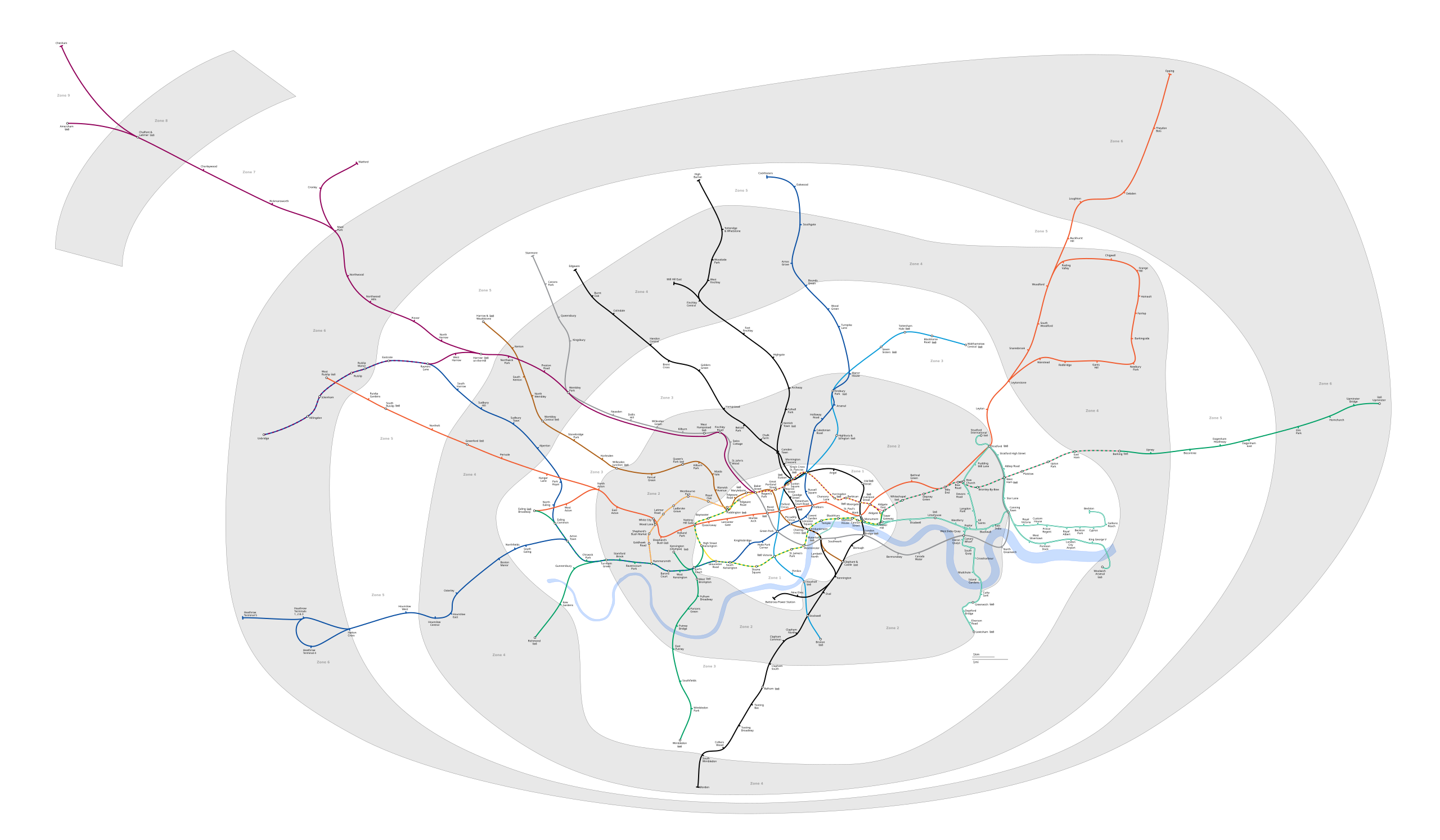
| Description | Geographic Map of the London Underground showing all stations with travelcard zones indicated | ||||||||
| Date | (UTC) | ||||||||
| Source | |||||||||
| Author |
|
||||||||
|
Permission
( Reusing this file ) |
I, the copyright holder of this work, hereby publish it under the following licenses:
This file is licensed under the
Creative Commons
Attribution-Share Alike
2.5 Generic
,
2.0 Generic
and
1.0 Generic
license.
You may select the license of your choice.
|
||||||||
| Other versions |
PNG version: File:London Underground full map.png File:SW Chinese Map of the London Underground.svg |

Original upload log
This image is a derivative work of the following images:
-
File:London_Underground_full_map.svg
licensed with Cc-by-sa-2.5,2.0,1.0, GFDL
- 2009-05-31T00:05:06Z DavidCane 1000x570 (292205 Bytes) Stations added (in non visible section of map): Wood Lane, Woolwich Arsenal, Langdon Park. Station renamed: Shepherd' Bush to Shepherd's Bush Market
- 2009-04-07T12:50:10Z Ed g2s 1000x570 (287789 Bytes) remove external file references
- 2009-04-07T12:47:04Z Ed g2s 1000x570 (289202 Bytes) {{Information |Description={{en|1=London Underground map}} |Source=Own work by uploader |Author=[[User:Ed g2s|Ed g2s]] |Date= |Permission= |other_versions= }}
Uploaded with derivativeFX