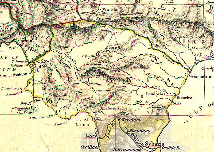
Lucania_da_The_Historical_Atlas,_by_William_R._Shepherd,_1911.png
Size of this preview:
800 × 569 pixels
.
Other resolutions:
320 × 228 pixels
|
640 × 455 pixels
|
911 × 648 pixels
.
Summary
| Description |
English:
Reference map for Roman Lucania from
The Historical Atlas
by William R. Shepherd, 1911 (Some particular of the soutern part of the map elaborated for integration)
Italiano:
Mappa di riferimento per la Lucania romana da
The Historical Atlas
di William R. Shepherd, 1911 (Alcuni particolari della parte sud della mappa sono stati rielaborati per integrazione)
|
| Date | Unknown date |
| Source | Own work |
| Author | GlióPanteco |
Licensing
|
|
I, the copyright holder of this work, release this work into the
public domain
. This applies worldwide.
In some countries this may not be legally possible; if so: I grant anyone the right to use this work for any purpose , without any conditions, unless such conditions are required by law. |