Luxembourg_Kirchberg_as_from_montée_Pfaffenthal_01.jpg
Size of this preview:
800 × 559 pixels
.
Other resolutions:
320 × 224 pixels
|
640 × 447 pixels
|
1,024 × 716 pixels
|
1,280 × 895 pixels
|
2,560 × 1,790 pixels
|
4,069 × 2,845 pixels
.

|
Copyright warning: A subject in this image is protected by copyright.
This image features an architectural or artistic work, photographed from a public space in Luxembourg. There are no
Freedom of Panorama
exemptions in Luxembourg, which means that they cannot be photographed freely for anything other than personal purposes.
If a copyrighted architectural or artistic work is contained in this image and it is a substantial reproduction, this photo cannot be licensed under a free license, and will be deleted . Framing this image to focus on the copyrighted work is also a copyright violation. Before reusing this content, ensure that you have the right to do so. You are solely responsible for ensuring that you do not infringe someone else's copyrights. See our general disclaimer for more information. |

Summary
| Description |
Deutsch:
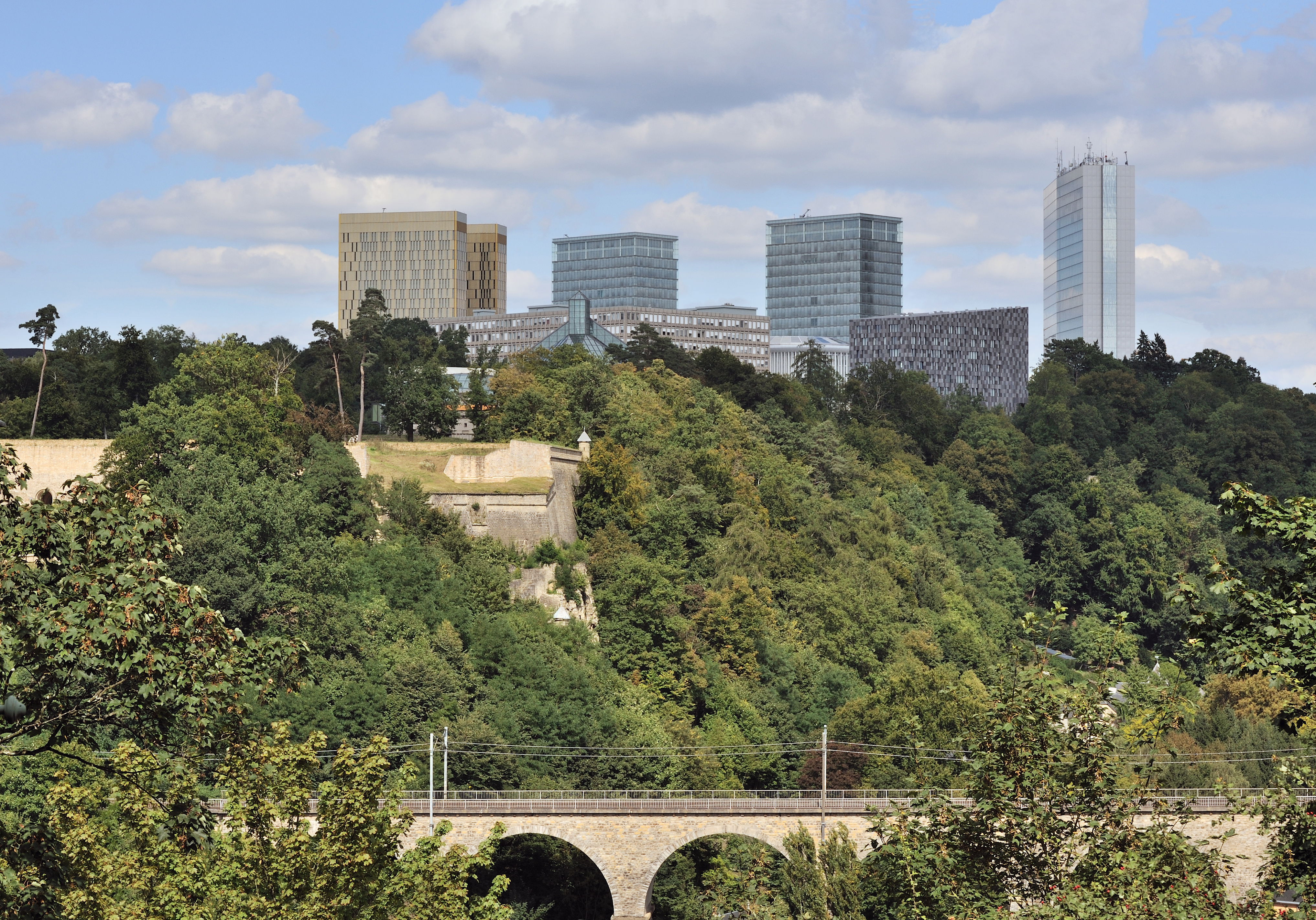
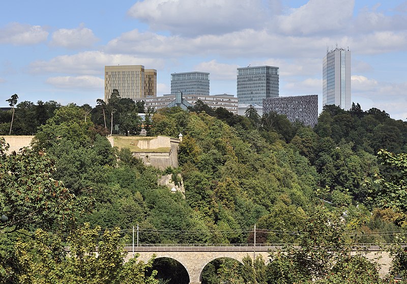
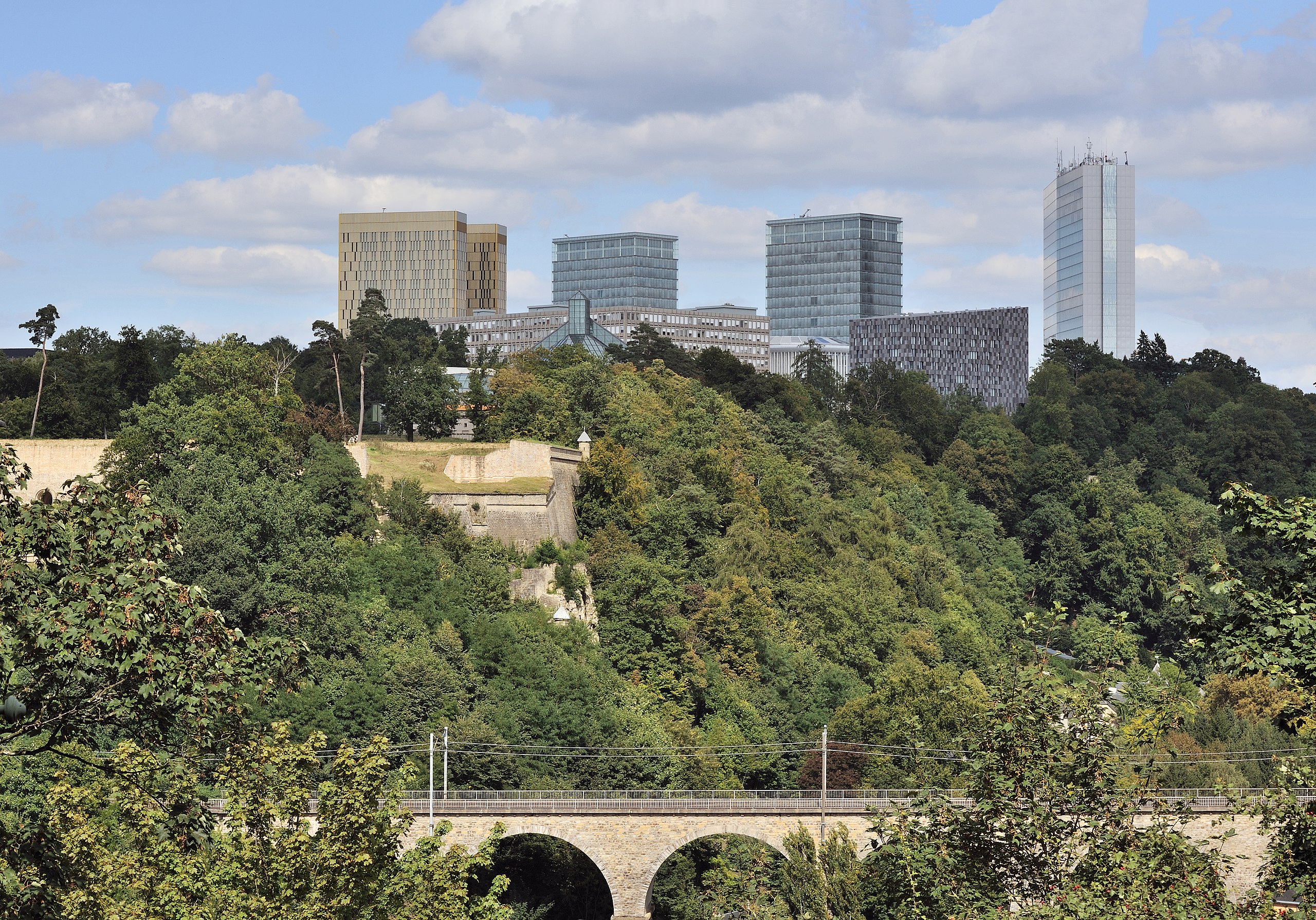
Luxemburg-Stadt: Plateau du Kirchberg, Blick von der Pfaffenthaler Anhöhe. Von links nach rechts sehen wir insbesondere: den Gerichtshof der Europäischen Gemeinschaften, das Großherzog-Jean-Museum für moderne Kunst - bekannt als Mudam -, die beiden Gebäude des Generalsekretariats des Europäischen Parlaments, den Alcide de Gasperi-Turm, der drei Monate im Jahr den Rat der Europäischen Union beherbergt.
English:
Luxembourg City: Plateau de Kirchberg as seen from montée du Pfaffenthal.
Français :
Luxembourg-ville : Plateau du
Kirchberg
, vue prise de la montée du Pfaffenthal. De gauche à droite, on voit notamment : la Cour de justice des Communautés européennes, le Musée d'art moderne grand-duc Jean - dit
Mudam
-, les deux bâtiments du Secrétariat général du Parlement européen, la tour Alcide de Gasperi qui héberge le Conseil de l'Union européenne trois mois par an.
Lëtzebuergesch:
Stad Lëtzebuerg: Kierchbierg-Plateau, vun der Montée du Pfaffenthal aus gesinn.
|
| Date | |
| Source | Own work |
| Author | Cayambe |
| Camera location |
|
View this and other nearby images on: OpenStreetMap |
|
|---|
Licensing
I, the copyright holder of this work, hereby publish it under the following licenses:
This file is licensed under the
Creative Commons
Attribution-Share Alike 3.0 Unported
license.
-
You are free:
- to share – to copy, distribute and transmit the work
- to remix – to adapt the work
-
Under the following conditions:
- attribution – You must give appropriate credit, provide a link to the license, and indicate if changes were made. You may do so in any reasonable manner, but not in any way that suggests the licensor endorses you or your use.
- share alike – If you remix, transform, or build upon the material, you must distribute your contributions under the same or compatible license as the original.

|
Permission is granted to copy, distribute and/or modify this document under the terms of the GNU Free Documentation License , Version 1.2 or any later version published by the Free Software Foundation ; with no Invariant Sections, no Front-Cover Texts, and no Back-Cover Texts. A copy of the license is included in the section entitled GNU Free Documentation License . |
You may select the license of your choice.
| Annotations | This image is annotated: View the annotations at Commons |
|
|
This image has been assessed using the
Quality image guidelines
and is considered a
Quality image
.
|