Malacca_Sultanate_en.svg

Size of this PNG preview of this SVG file:
512 × 581 pixels
.
Other resolutions:
211 × 240 pixels
|
423 × 480 pixels
|
677 × 768 pixels
|
902 × 1,024 pixels
|
1,805 × 2,048 pixels
.
Summary
| Description |
English:
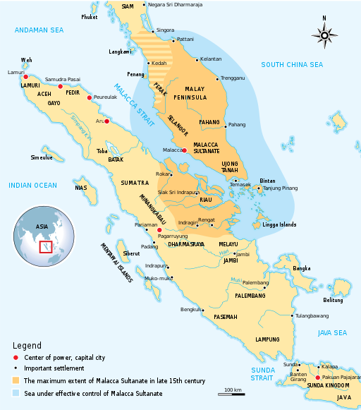
The historical map of Malacca Sultanate (1402–1511) Malay Peninsula and East Coast of Sumatra. Made and improved based on "Atlas Sejarah Indonesia dan Dunia" (The Atlas of Indonesian and World History), PT Pembina Peraga Jakarta 1996.
|
| Date | |
| Source | Own work |
| Author | Gunawan Kartapranata |
|
Permission
( Reusing this file ) |
I, the copyright holder of this work, hereby publish it under the following license:
This file is licensed under the
Creative Commons
Attribution-Share Alike 3.0 Unported
license.
|
| Other versions |
[
]
|


|
This SVG file contains embedded text that can be translated into your language, using any capable SVG editor, text editor or the SVG Translate tool . For more information see: About translating SVG files . |