Mamluk_Sultanate_of_Cairo_1317_AD.jpg

Size of this preview:
636 × 600 pixels
.
Other resolutions:
254 × 240 pixels
|
509 × 480 pixels
|
814 × 768 pixels
|
1,086 × 1,024 pixels
|
1,800 × 1,698 pixels
.
Summary
| Description |
English:
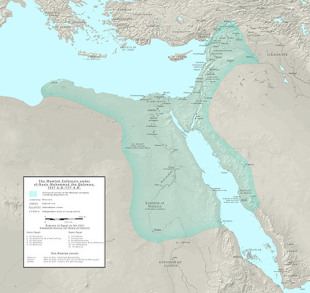
Map of the Mamluk sultanate during the third reign of al-Nasir Muhammad, 1317 AD, showing its political subdivisions and cities. Borders are approximate only.
The primary resource used is the Encyclopedia of Islam, New Edition; see the articles regarding the various places, dynasties and individuals featured in the map. The articles on Diyar Mudar, al-Sa'id and Nuba were also referenced. Works cited:
|
| Date | |
| Source | Own work |
| Author | Ro4444 |
Licensing
I, the copyright holder of this work, hereby publish it under the following license:
This file is licensed under the
Creative Commons
Attribution-Share Alike 4.0 International
license.
-
You are free:
- to share – to copy, distribute and transmit the work
- to remix – to adapt the work
-
Under the following conditions:
- attribution – You must give appropriate credit, provide a link to the license, and indicate if changes were made. You may do so in any reasonable manner, but not in any way that suggests the licensor endorses you or your use.
- share alike – If you remix, transform, or build upon the material, you must distribute your contributions under the same or compatible license as the original.