Manorhamilton_Castle_-_geograph.org.uk_-_1495776.jpg
No higher resolution available.
Summary
| Description |
English:
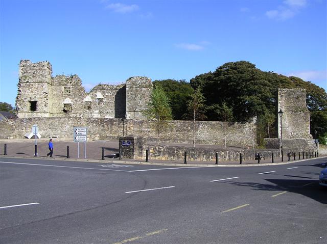
Manorhamilton Castle The castle was built as a baronial mansion during the plantation of Leitrim by Sir Frederick Hamilton in 1634.
Hamilton proved to be a tyrant, noted for his cruelty to prisoners, many of whom he is known to have publicly hanged. After sustained rebellion the Castle was burned to the ground in 1652 by the native Irish, although not before Hamilton had taken the opportunity to burn Sligo town. more at
http://www.passport-breifne.com/Attractions/Attractionindetail.cfm/showme/7
|
| Date | |
| Source | From geograph.org.uk |
| Author | Kenneth Allen |
|
Attribution
( required by the license ) |
Kenneth Allen / Manorhamilton Castle / |
| Camera location |
|
View this and other nearby images on: OpenStreetMap |
|
|---|
_heading:90.00&language=en)
| Object location |
|
View this and other nearby images on: OpenStreetMap |
|
|---|
_heading:90.00&language=en)
Licensing

|
This image was taken from the
Geograph project
collection. See
this photograph's page
on the Geograph website for the photographer's contact details. The copyright on this image is owned by
Kenneth Allen
and is licensed for reuse under the
Creative Commons
Attribution-ShareAlike 2.0 license.
|
This file is licensed under the
Creative Commons
Attribution-Share Alike 2.0 Generic
license.
Attribution:
Kenneth Allen
-
You are free:
- to share – to copy, distribute and transmit the work
- to remix – to adapt the work
-
Under the following conditions:
- attribution – You must give appropriate credit, provide a link to the license, and indicate if changes were made. You may do so in any reasonable manner, but not in any way that suggests the licensor endorses you or your use.
- share alike – If you remix, transform, or build upon the material, you must distribute your contributions under the same or compatible license as the original.