Mansfield_Old_Town_Hall_and_Old_Court.JPG
No higher resolution available.
Summary
| Description |
English:
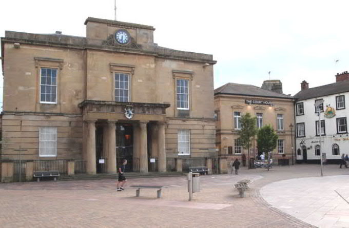
Mansfield Old Town Hall and Old Court building at the head of Mansfield Market Place. The old town hall is used for council-related purposes, and the old court is a pub as of 2014
|
| Date | |
| Source |
This file was derived from:
Mansfield, Notts - NG18 (geograph 3004076).jpg
|
| Author | David Hallam-Jones |
.jpg)
| Camera location |
|
View this and other nearby images on: OpenStreetMap |
|
|---|
_heading:225.00&language=en)
| Object location |
|
View this and other nearby images on: OpenStreetMap |
|
|---|
_heading:225.00&language=en)
Cropped from original to reduce at three edges to reduce sky, foreground and edge-building, then enlarged slightly and levels adjusted slightly
Licensing
This file is licensed under the
Creative Commons
Attribution-Share Alike 2.5 Generic
license.
-
You are free:
- to share – to copy, distribute and transmit the work
- to remix – to adapt the work
-
Under the following conditions:
- attribution – You must give appropriate credit, provide a link to the license, and indicate if changes were made. You may do so in any reasonable manner, but not in any way that suggests the licensor endorses you or your use.
- share alike – If you remix, transform, or build upon the material, you must distribute your contributions under the same or compatible license as the original.