Map_Alexander_von_Humboldt_expedition-en.svg

Size of this PNG preview of this SVG file:
800 × 535 pixels
.
Other resolutions:
320 × 214 pixels
|
640 × 428 pixels
|
1,024 × 685 pixels
|
1,280 × 856 pixels
|
2,560 × 1,713 pixels
|
2,844 × 1,903 pixels
.
Summary
| Description |
Deutsch:
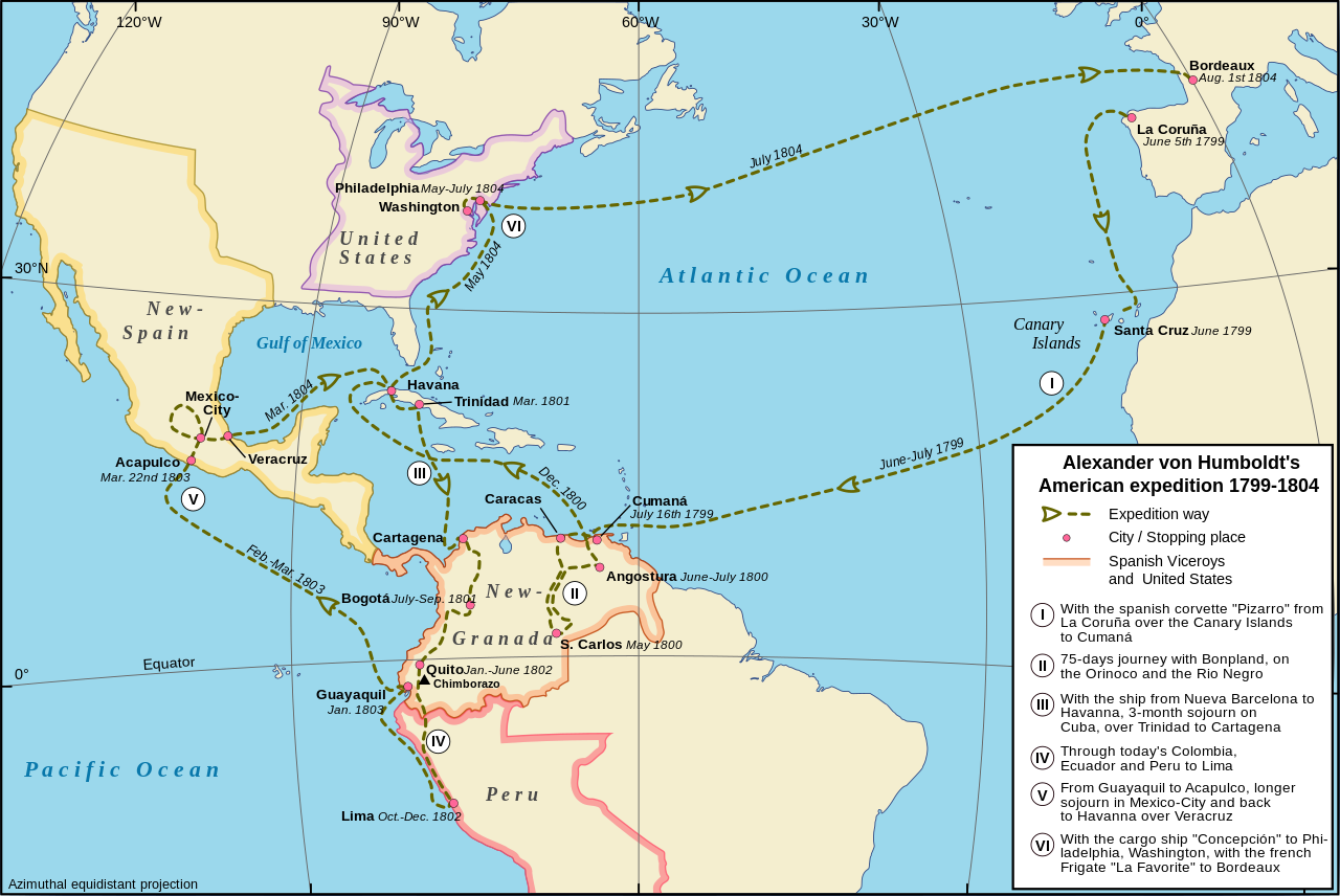
Amerikanische Forschungsreise des Alexander von Humboldt, 1799-1804
English:
Alexander von Humboldt's American expedition from 1799-1804
Français :
L'expédition américaine d'Alexander von Humboldt, 1799-1804
date= 2009-07
|
||
| Source |
Own work (original text:
Topographic map: vmap0 (Vector Map Level 0), Dates and Positions:
Alexander von Humboldt Chronologie
)
|
||
| Author | Alexrk translated by Cäsium137 (T.) | ||
| Other versions |
Derivative works of this file:
AvHumboldts Americatravel map mk.svg
[
]
|
||
| SVG development |
This
map
was created with an unknown SVG tool.
|


Licensing
This file is licensed under the
Creative Commons
Attribution-Share Alike 2.5 Generic
license.
-
You are free:
- to share – to copy, distribute and transmit the work
- to remix – to adapt the work
-
Under the following conditions:
- attribution – You must give appropriate credit, provide a link to the license, and indicate if changes were made. You may do so in any reasonable manner, but not in any way that suggests the licensor endorses you or your use.
- share alike – If you remix, transform, or build upon the material, you must distribute your contributions under the same or compatible license as the original.