Map_Byzantine_Empire_1025-en.svg

Size of this PNG preview of this SVG file:
800 × 450 pixels
.
Other resolutions:
320 × 180 pixels
|
640 × 360 pixels
|
1,024 × 576 pixels
|
1,280 × 720 pixels
|
2,560 × 1,440 pixels
|
1,963 × 1,104 pixels
.
This
W3C-unspecified
vector image
was created with
Inkscape
.
Summary
| Description |
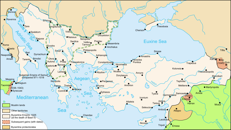
Türkçe:
1025'te Doğu Roma İmparatorluğu sınırları.
|
| Date | |
| Source | Translated and extensively modified from Image:Map_Byzantine_Empire_1025-de.svg |
| Author | Nécropotame (French version); Cplakidas (English translation) |
|
Permission
( Reusing this file ) |
This file is licensed under the
Creative Commons
Attribution-Share Alike 2.5 Generic
license.
|
| Other versions |
[
]
|


|
This SVG file contains embedded text that can be translated into your language, using any capable SVG editor, text editor or the SVG Translate tool . For more information see: About translating SVG files . |