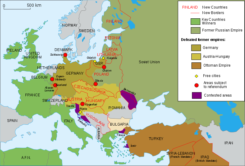
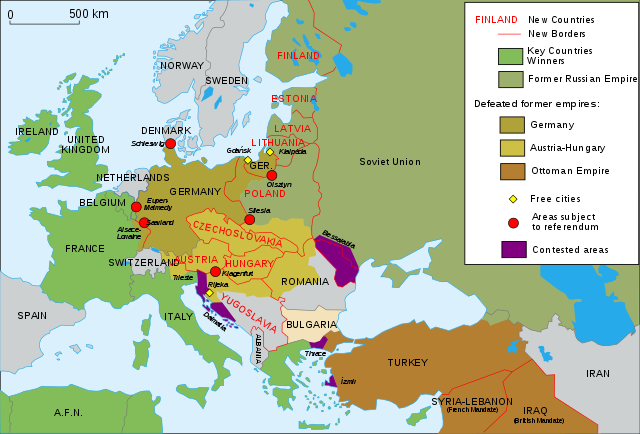
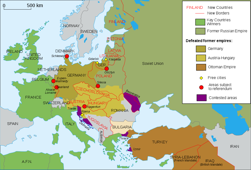
Map_Europe_1923-en.svg

Size of this PNG preview of this SVG file:
800 × 543 pixels
.
Other resolutions:
320 × 217 pixels
|
640 × 434 pixels
|
1,024 × 695 pixels
|
1,280 × 869 pixels
|
2,560 × 1,738 pixels
|
1,037 × 704 pixels
.
| Description |
English
:
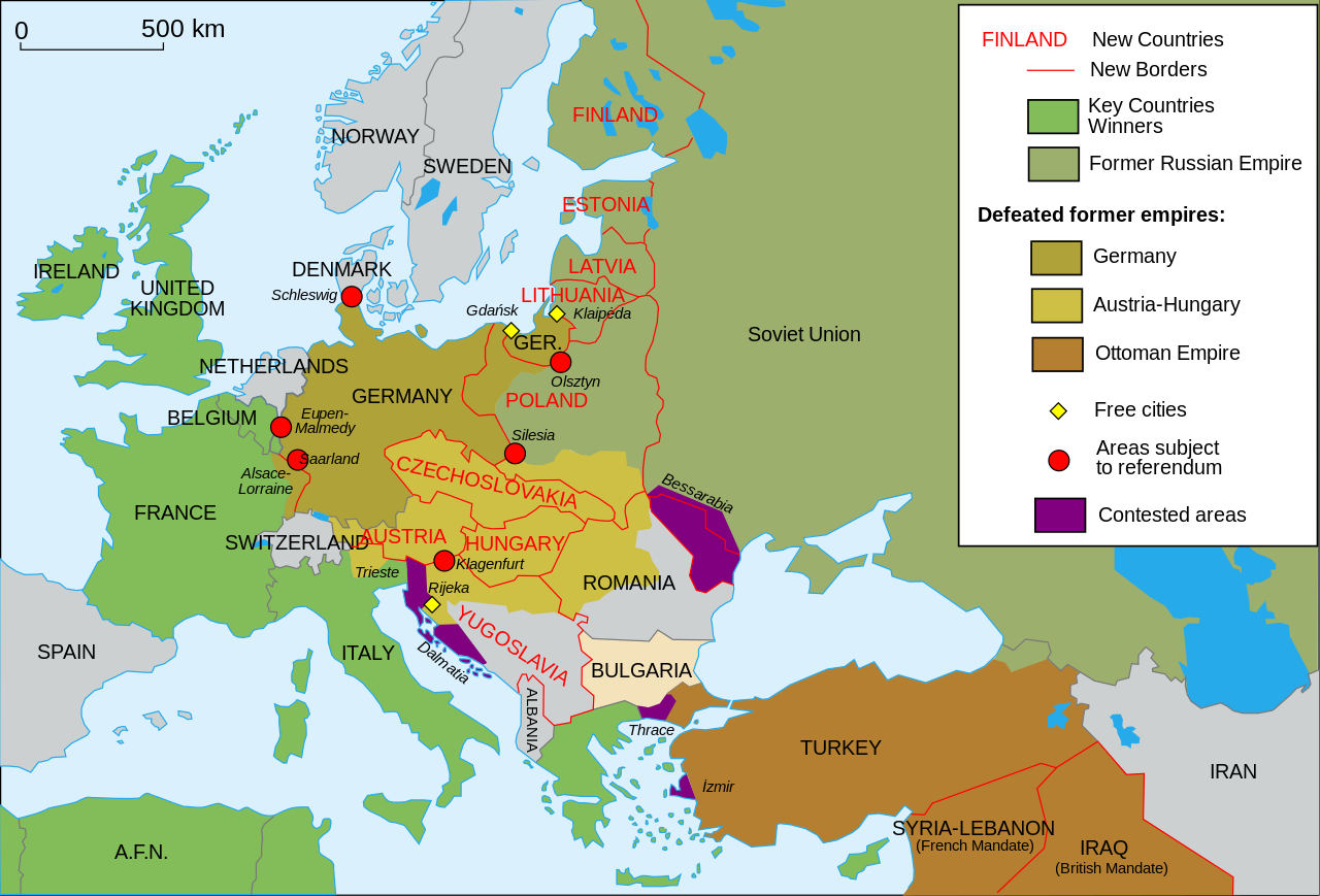
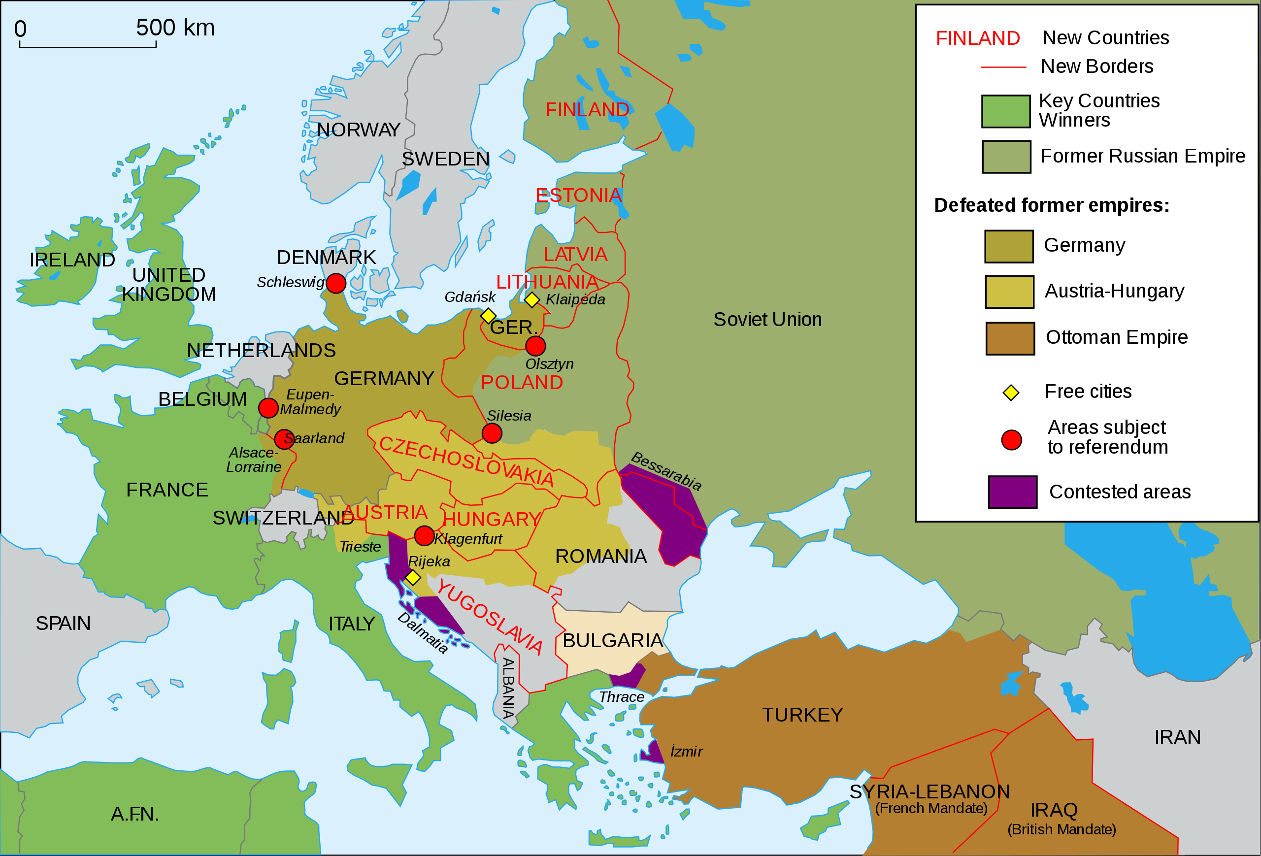
Map of Europe and Western Asia in 1923 after World War I
Español
:
Mapa de Europa y Asia en 1923
Français
:
Carte de l'Europe en 1923.
Português
:
Mapa da Europa e da Ásia em 1923
অসমীয়া
:
প্ৰথম বিশ্বযুদ্ধৰ পিছত ১৯২৩ চনত ইউৰোপ আৰু পশ্চিম এছিয়াৰ মানচিত্ৰ
বাংলা
:
প্রথম বিশ্বযুদ্ধের পর ১৯২৩ সালে ইউরোপ ও পশ্চিম এশিয়ার মানচিত্র
|
| Date | (UTC) |
| Source | |
| Author |
|
| Other versions |
Derivative works of this file:
[
]
|
| SVG development |
This
vector image
was created with
Inkscape
, or with something else
.
This file uses
embedded
text that can be
easily translated
using a text editor.
|


I, the copyright holder of this work, hereby publish it under the following license:
This file is licensed under the
Creative Commons
Attribution-Share Alike
2.5 Generic
,
2.0 Generic
and
1.0 Generic
license.
-
You are free:
- to share – to copy, distribute and transmit the work
- to remix – to adapt the work
-
Under the following conditions:
- attribution – You must give appropriate credit, provide a link to the license, and indicate if changes were made. You may do so in any reasonable manner, but not in any way that suggests the licensor endorses you or your use.
- share alike – If you remix, transform, or build upon the material, you must distribute your contributions under the same or compatible license as the original.
Original upload log
This image is a derivative work of the following images:
-
File:Map_Europe_1923-fr.svg
licensed with Cc-by-sa-2.5,2.0,1.0, Cc-by-sa-2.5,2.0,1.0/en
- 2007-04-19T18:31:16Z Bibi Saint-Pol 1037x704 (191242 Bytes) {{Information |Description= {{en|Map of Europe in 1923.}} {{fr|Carte de l'Europe en 1923.}} |Source=Own work |Date=2007-02-16 |Author=[[User:Historicair|Historicair]] |Permission={{self2|GFDL|cc-by-sa-2.5,2.0,1.0}} |other_ver
Uploaded with derivativeFX

|
This SVG file contains embedded text that can be translated into your language, using any capable SVG editor, text editor or the SVG Translate tool . For more information see: About translating SVG files . |