Map_Greco-Persian_Wars-en.svg

Size of this PNG preview of this SVG file:
750 × 600 pixels
.
Other resolutions:
300 × 240 pixels
|
601 × 480 pixels
|
961 × 768 pixels
|
1,280 × 1,023 pixels
|
2,560 × 2,046 pixels
|
992 × 793 pixels
.
This
W3C-unspecified
vector image
was created with
Inkscape
.
Summary
| Description |
English:
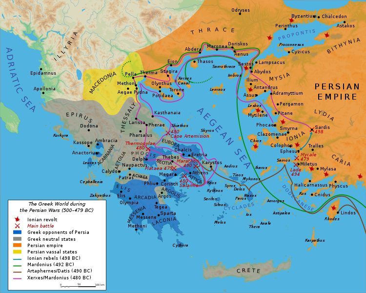
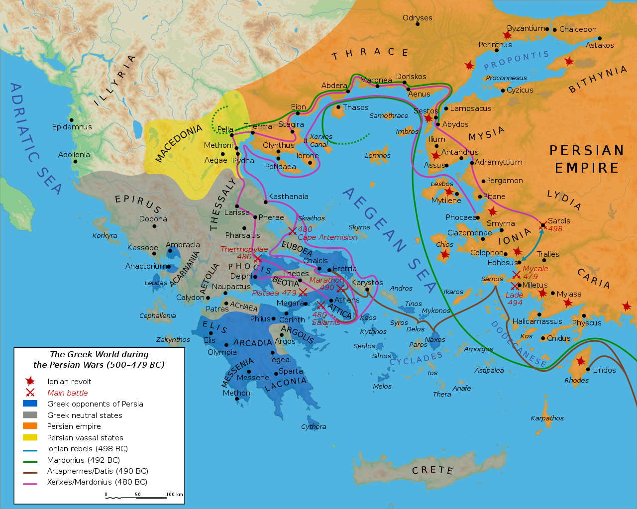
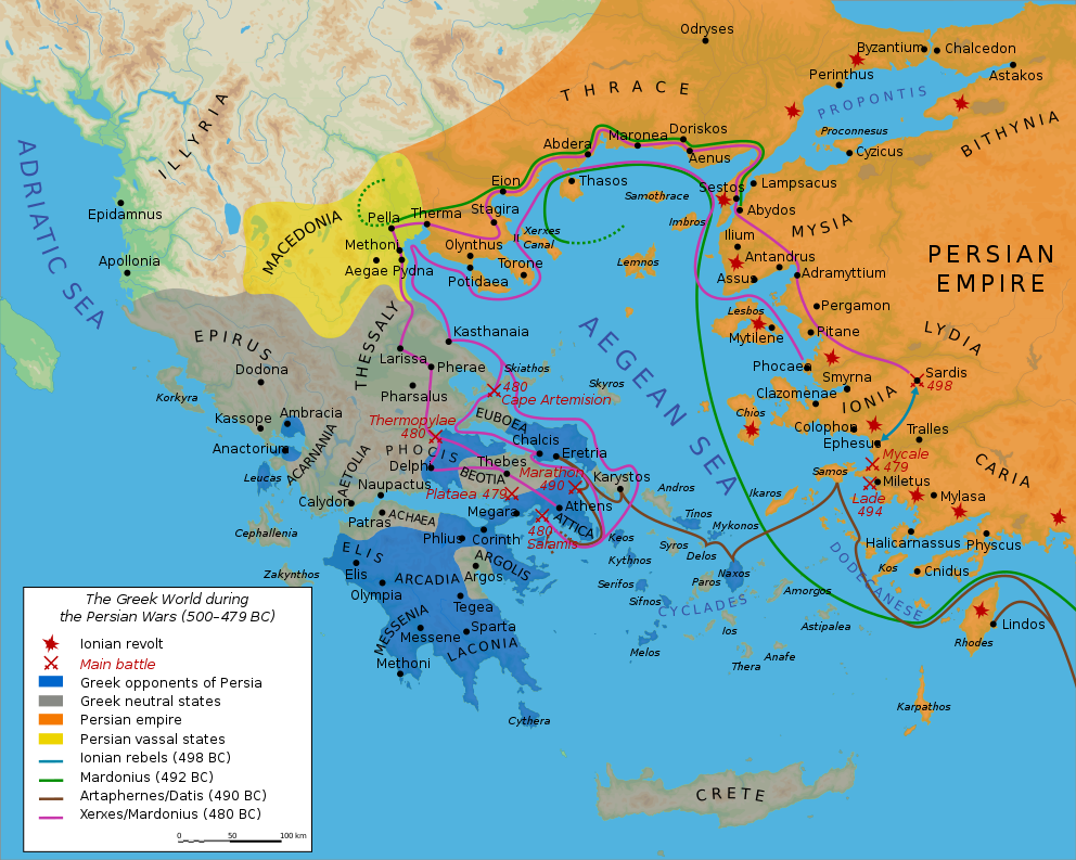
Map showing the Greek world during the Greco-Persian Wars (ca. 500–479 BC).
|
||||||||
| Date | |||||||||
| Source | Own work. Data from Image:Perserkriege.jpg by Captain Blood , which uses the dtv-Atlas Weltgeschichte. Von den Anfängen bis zur Gegenwart , p. 56. Blank map from Image:Map greek sanctuaries-fr.svg . | ||||||||
| Author | User:Bibi Saint-Pol | ||||||||
|
Permission
( Reusing this file ) |
I, the copyright holder of this work, hereby publish it under the following licenses:
This file is licensed under the
Creative Commons
Attribution-Share Alike 2.5 Generic
license.
You may select the license of your choice.
|
||||||||
| Other versions |
[
]
|


|
This SVG file contains embedded text that can be translated into your language, using any capable SVG editor, text editor or the SVG Translate tool . For more information see: About translating SVG files . |