Map_Iberian_Peninsula_910-es.svg

Size of this PNG preview of this SVG file:
800 × 556 pixels
.
Other resolutions:
320 × 223 pixels
|
640 × 445 pixels
|
1,024 × 712 pixels
|
1,280 × 890 pixels
|
2,560 × 1,781 pixels
|
818 × 569 pixels
.
Summary
| Description |
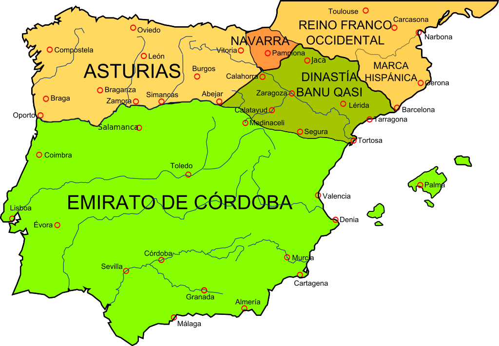
Deutsch:
Landkarte der Iberischen Halbinsel im Jahr 910
English:
Map of the Iberian Peninsula in 910
Español:
Mapa de la península ibérica en el 910
|
| Date | |
| Source | File:España910.jpg from this map , liberated to the public domain by the University of Texas |
| Author | Crates |
| Other versions |
[
]
See also
|


Licensing
I, the copyright holder of this work, hereby publish it under the following licenses:

|
Permission is granted to copy, distribute and/or modify this document under the terms of the GNU Free Documentation License , Version 1.2 or any later version published by the Free Software Foundation ; with no Invariant Sections, no Front-Cover Texts, and no Back-Cover Texts. A copy of the license is included in the section entitled GNU Free Documentation License . |
This file is licensed under the
Creative Commons
Attribution-Share Alike
4.0 International
,
3.0 Unported
,
2.5 Generic
,
2.0 Generic
and
1.0 Generic
license.
-
You are free:
- to share – to copy, distribute and transmit the work
- to remix – to adapt the work
-
Under the following conditions:
- attribution – You must give appropriate credit, provide a link to the license, and indicate if changes were made. You may do so in any reasonable manner, but not in any way that suggests the licensor endorses you or your use.
- share alike – If you remix, transform, or build upon the material, you must distribute your contributions under the same or compatible license as the original.
You may select the license of your choice.