Map_of_East_and_West_Florida_in_1819.jpg

No higher resolution available.
Summary
| Description |
English:
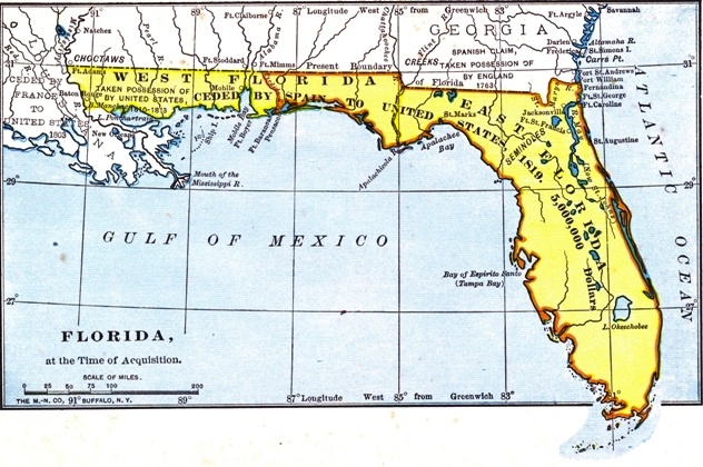
The British had divided Florida into the administrative units of East Florida and West Florida during their ownership (1763–1783).
|
| Date | |
| Source |
Project Gutenberg http://www.gutenberg.org/files/35558/35558-h/images/2.jpg |
| Author | Unknown author |
Licensing
|
|
This work is in the
public domain
in the
United States
because it was
published
(or registered with the
U.S. Copyright Office
) before January 1, 1929.
Public domain works must be out of copyright in both the United States and in the source country of the work in order to be hosted on the Commons. If the work is not a U.S. work, the file
must
have an additional
copyright tag
indicating the copyright status in the source country.
Note: This tag should not be used for sound recordings. |