Map_of_Hispaniola.JPG
Size of this preview:
780 × 600 pixels
.
Other resolutions:
312 × 240 pixels
|
625 × 480 pixels
|
999 × 768 pixels
|
1,280 × 984 pixels
|
2,286 × 1,757 pixels
.
Summary
| Description |
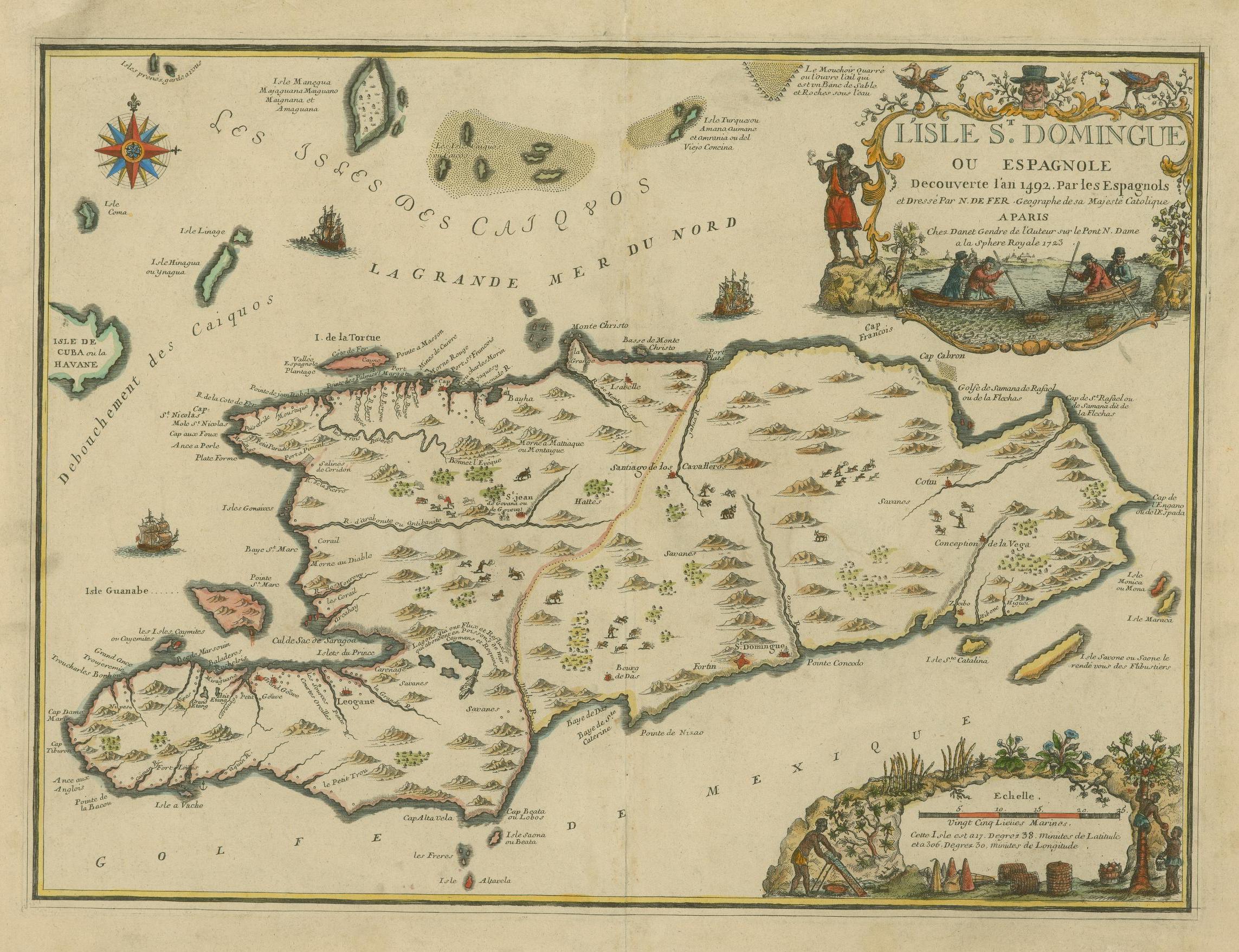
English:
The island of Santo Domingo or Hispaniola, discovered in 1492.
Français :
L'Isle St. Domingue ou Espagnole Decouverte l'an 1492. Par les Espagnols
|
||||||||||||||||||||
| Date | |||||||||||||||||||||
| Source |
https://jcb.lunaimaging.com/luna/servlet/s/3l9bzf JCB Map Cabinet Em 723 FeN library catalog record |
||||||||||||||||||||
| Author |
|
||||||||||||||||||||


Licensing
|
|
This work is in the public domain in its country of origin and other countries and areas where the copyright term is the author's life plus 100 years or fewer . This work is in the public domain in the United States because it was published (or registered with the U.S. Copyright Office ) before January 1, 1929. |
| This file has been identified as being free of known restrictions under copyright law, including all related and neighboring rights. | |