Map_of_Iceland.svg

Size of this PNG preview of this SVG file:
739 × 600 pixels
.
Other resolutions:
296 × 240 pixels
|
591 × 480 pixels
|
946 × 768 pixels
|
1,261 × 1,024 pixels
|
2,523 × 2,048 pixels
|
1,834 × 1,489 pixels
.
Summary
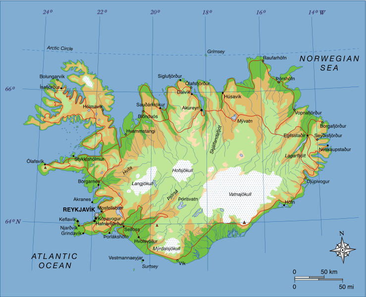
| Description | A map of Iceland, showing major towns, rivers, lakes and glaciers. Translated from a map on the Greek Wikipedia ( located here ). |
| Date | |
| Source | Own work , based on File:Map of Iceland el.svg created by el:user:Αντιγόνη |
| Author | Max Naylor |
Licensing
|
|
This work has been released into the
public domain
by its author,
I,
Max Naylor
. This applies worldwide.
In some countries this may not be legally possible; if so: I, Max Naylor grants anyone the right to use this work for any purpose , without any conditions, unless such conditions are required by law. |
| Annotations | This image is annotated: View the annotations at Commons |