Map_of_Israel,_neighbours_and_occupied_territories.svg

Size of this PNG preview of this SVG file:
465 × 600 pixels
.
Other resolutions:
186 × 240 pixels
|
372 × 480 pixels
|
595 × 768 pixels
|
794 × 1,024 pixels
|
1,588 × 2,048 pixels
|
559 × 721 pixels
.
Summary
| Description |
English:
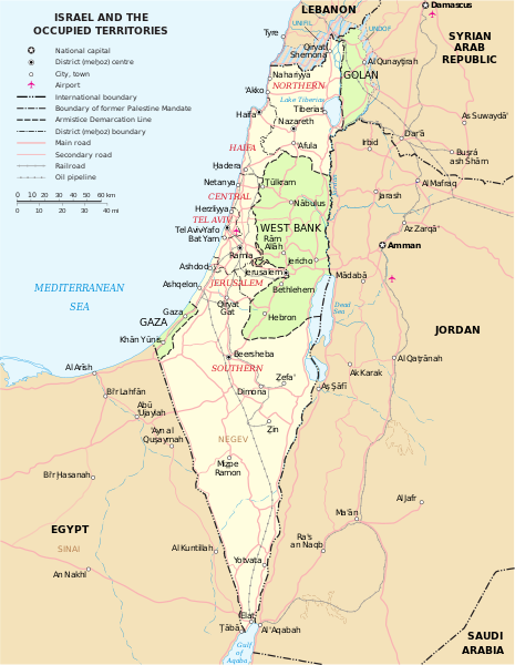
Map of the Middle East showing Israel, Egypt, Saudi Arabia, Jordan, Syria and Lebanon including Gaza, Golan Heights and West Bank.
العربية:
خريطة دولة إسرائيل والأراضي الفلسطينية التي تشمل الضفة الغربية وقطاع غزة والجولان السوري المحتل.
|
| Date | |
| Source | SVG extracted and edited from PDF |
| Author | un.org |
| Other versions | македонски |
| SVG development |
Licensing
|
|
This image is a map derived from a
United Nations
map.
Unless stated otherwise, UN maps are to be considered in the public domain. This applies worldwide.
UN maps are, in principle, open source material and you can use them in your work or for making your own map. UN requests however that you delete the UN name, logo and reference number upon any modification to the map. Content of your map will be your responsibility. You can state in your publication, if you wish, something like: based on UN map … (map name, map number, revision number and date). See: Geospatial Information Section . And: Geospatial, location data for a better world . |

|
|
|
I, the copyright holder of this work, release this work into the
public domain
. This applies worldwide.
In some countries this may not be legally possible; if so: I grant anyone the right to use this work for any purpose , without any conditions, unless such conditions are required by law. |