Map_of_Kentucky_NA_(cropped).png
Size of this preview:
800 × 564 pixels
.
Other resolutions:
320 × 226 pixels
|
640 × 451 pixels
|
1,024 × 722 pixels
|
1,280 × 902 pixels
|
1,562 × 1,101 pixels
.
Summary
| Description |
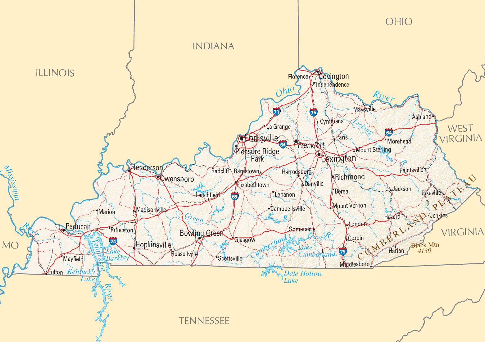
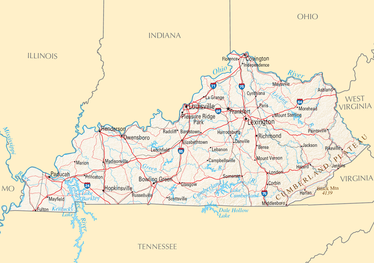
English:
Reference Map of
Kentucky
.
|
| Date | |
| Source | |
| Author | National Atlas of the United States |
|
Permission
( Reusing this file ) |
Public domain |
| Other versions |

Licensing
|
|
This map was obtained from an edition of the
National Atlas of the United States
. Like almost all works of the U.S. federal government, works from the
National Atlas
are in the
public domain
in the United States.
Online access: NationalAtlas.gov | 1970 print edition: Library of Congress , Perry-Castañeda Library
|
|