Map_of_Poland_(1945).png
No higher resolution available.

|
This
historical map
image could be re-created
using
vector graphics
as an
SVG
file
. This has several advantages; see
Commons:Media for cleanup
for more information. If an SVG form of this image is available, please upload it and afterwards replace this template with
{{

vector version available

|

new image name

}}
.
It is recommended to name the SVG file “Map of Poland (1945).svg”—then the template Vector version available (or Vva ) does not need the new image name parameter. |
Summary
| Description |
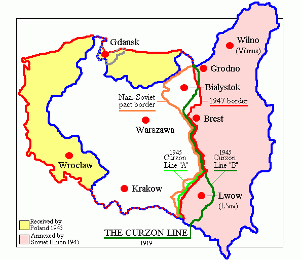
English:
Map of Poland in 1945.
Deutsch:
Karte Polens (1945).
|
| Date | |
| Source | Own work (originally at en.wikipedia) |
| Author | Adam Carr |
| Other versions | Derivative works of this file: Polszczyzna kresowa.png |
Licensing
|
|
This work has been released into the
public domain
by its author,
Adam Carr
, at the
English Wikipedia
project
. This applies worldwide.
In case this is not legally possible:
|