Map_of_Somerset_in_1646.jpg
Size of this preview:
780 × 600 pixels
.
Other resolutions:
312 × 240 pixels
|
625 × 480 pixels
|
999 × 768 pixels
|
1,280 × 984 pixels
|
2,560 × 1,968 pixels
|
5,500 × 4,228 pixels
.
Summary
| Description |
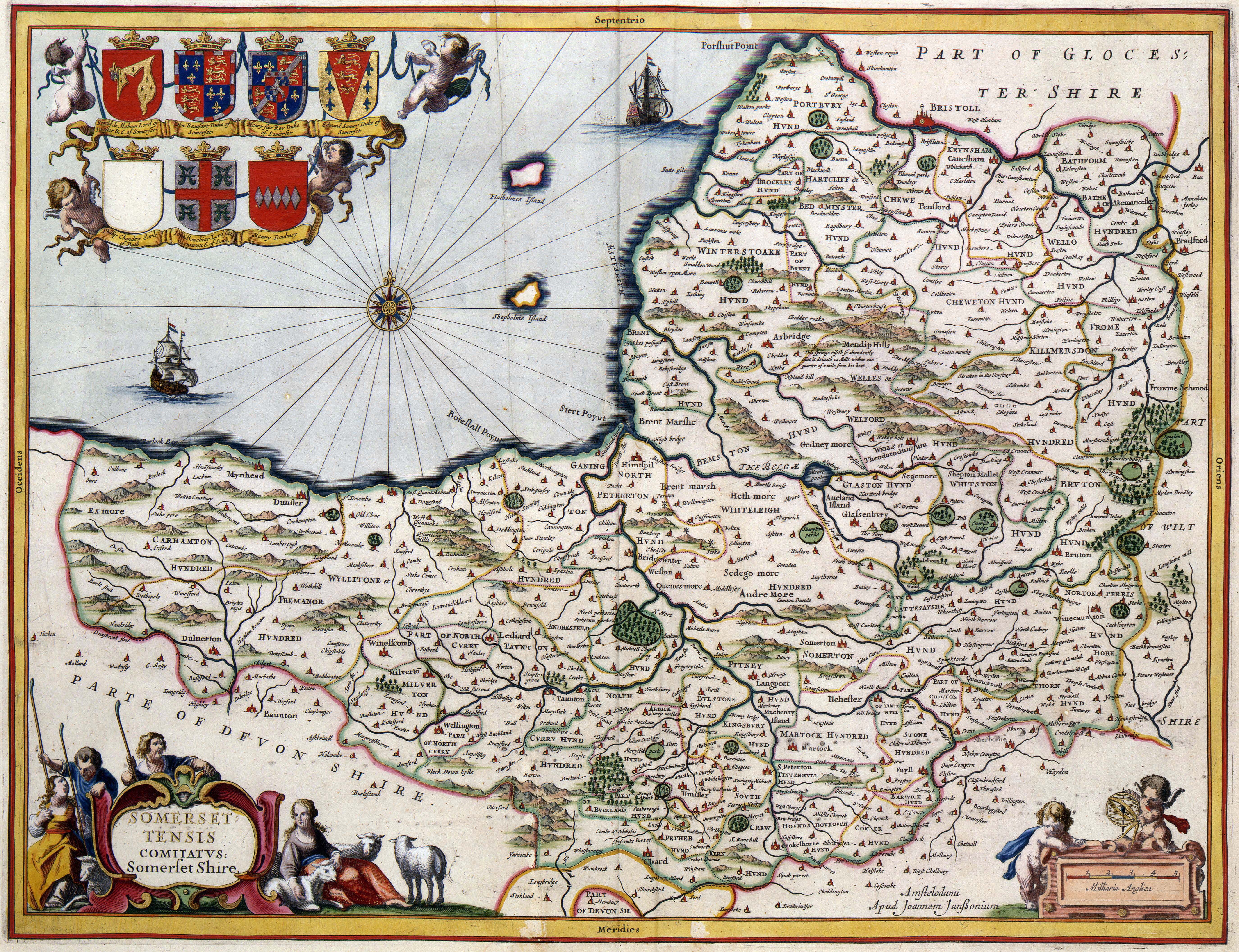
English:
A map of Somerset drawn in 1646. In 1645,
Joan Blaeu
(1598-1673) successfully published an atlas of England. Blaeu based this atlas on the Theatre of the Empire of Great Britaine published by his English colleague
John Speed
(1552-1629) in 1611. Infected by this success, Blaeus neighbour,
Jan Janssonius
(1588-1664), copied the complete atlas. Janssonius published this pirate issue in 1646. This map of Somerset has been taken from Janssonius atlas. The map is enriched with allegorical figures and attributes representing the economical and cultural character of the province.
|
|||||
| Date | ||||||
| Source | http://resolver.kb.nl/resolve?urn=urn:gvn:KONB01:1049B11_009&size=large - Source page at the Geheugen van Nederland / Memory of the Netherlands website | |||||
| Author | unknown c1646 | |||||
|
Permission
( Reusing this file ) |
|
|||||
|
|
This digital media file - and/or the physical objects depicted on it - originates from the digital and/or physical collections of the
Koninklijke Bibliotheek
, national library of the Netherlands.
|
Licensing
|
|
This work is in the public domain in its country of origin and other countries and areas where the copyright term is the author's life plus 100 years or fewer . |
| This file has been identified as being free of known restrictions under copyright law, including all related and neighboring rights. | |