Map_of_populous_North_America_(physical,_political,_population).jpg

Size of this preview:
741 × 600 pixels
.
Other resolutions:
297 × 240 pixels
|
593 × 480 pixels
|
949 × 768 pixels
|
1,265 × 1,024 pixels
|
2,530 × 2,048 pixels
|
4,061 × 3,287 pixels
.
Summary
| Description |
English:
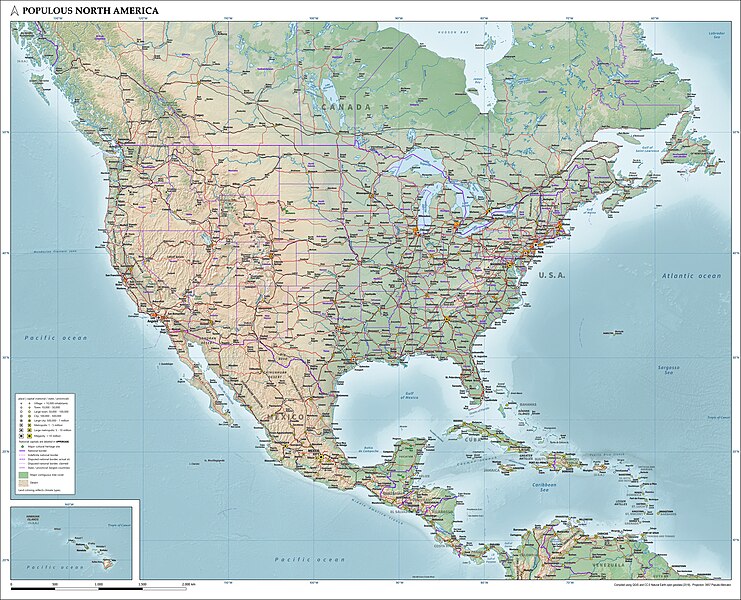
Map of the populous part of North America showing physical, political and population characteristics, with legend, in Mercator projection, as per 2018. Compiled using QGIS and CC-0 Natural Earth geodata.
|
| Date | |
| Source | Own work |
| Author | Janwillemvanaalst |
Licensing
I, the copyright holder of this work, hereby publish it under the following license:
This file is licensed under the
Creative Commons
Attribution 4.0 International
license.
-
You are free:
- to share – to copy, distribute and transmit the work
- to remix – to adapt the work
-
Under the following conditions:
- attribution – You must give appropriate credit, provide a link to the license, and indicate if changes were made. You may do so in any reasonable manner, but not in any way that suggests the licensor endorses you or your use.