Map_of_the_center_of_Kielce.svg

Size of this PNG preview of this SVG file:
800 × 461 pixels
.
Other resolutions:
320 × 185 pixels
|
640 × 369 pixels
|
1,024 × 591 pixels
|
1,280 × 738 pixels
|
2,560 × 1,477 pixels
|
1,250 × 721 pixels
.
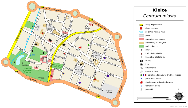
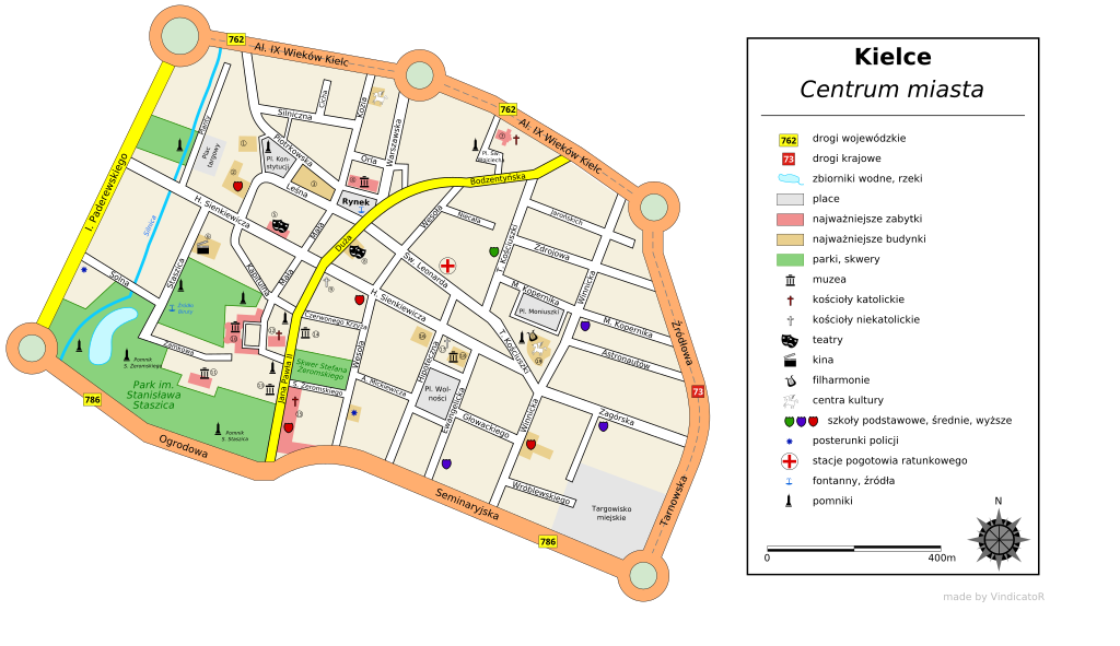
| Description |
English:
Map of the center of
Kielce
,
Poland
Polski:
Mapa centrum
Kielc
, w widłach ulic: Al. XIX w. Kielc, Paderewskiego, Źródłowej, Seminaryjskiej i Ogrodowej. Uwagi proszę zgłaszać na mojej
stronie dyskusji
This
W3C-unspecified
vector image
was created with
Inkscape
.
|
||
| Source | Own work | ||
| Author | Vindicator | ||
|
Permission
( Reusing this file ) |
I, the copyright holder of this work, hereby publish it under the following licenses:
This file is licensed under the
Creative Commons
Attribution-Share Alike
3.0 Unported
,
2.5 Generic
,
2.0 Generic
and
1.0 Generic
license.
You may select the license of your choice.
|
