Mapa_Mexico_1845.PNG
Size of this preview:
659 × 599 pixels
.
Other resolutions:
264 × 240 pixels
|
528 × 480 pixels
|
844 × 768 pixels
|
1,126 × 1,024 pixels
|
1,669 × 1,518 pixels
.
Summary
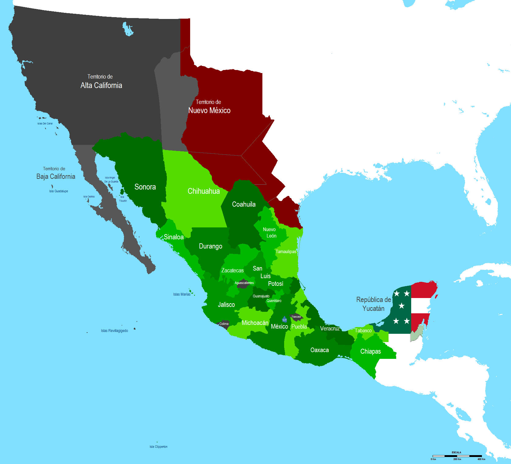
| Description |
English:
Map of Mexico 1845 after Texas annexation by U.S.A.
Español:
Mapa de Mexico en 1845 despues de la anexion de Texas por los Estados Unidos
|
| Date | |
| Source | Own work |
| Author | Hpav7 |
Licensing
|
|
I, the copyright holder of this work, release this work into the
public domain
. This applies worldwide.
In some countries this may not be legally possible; if so: I grant anyone the right to use this work for any purpose , without any conditions, unless such conditions are required by law. |