Marlboro_Town_House_side_view.jpg
Size of this preview:
800 × 519 pixels
.
Other resolutions:
320 × 208 pixels
|
640 × 415 pixels
|
1,024 × 665 pixels
|
1,280 × 831 pixels
|
2,075 × 1,347 pixels
.
Summary
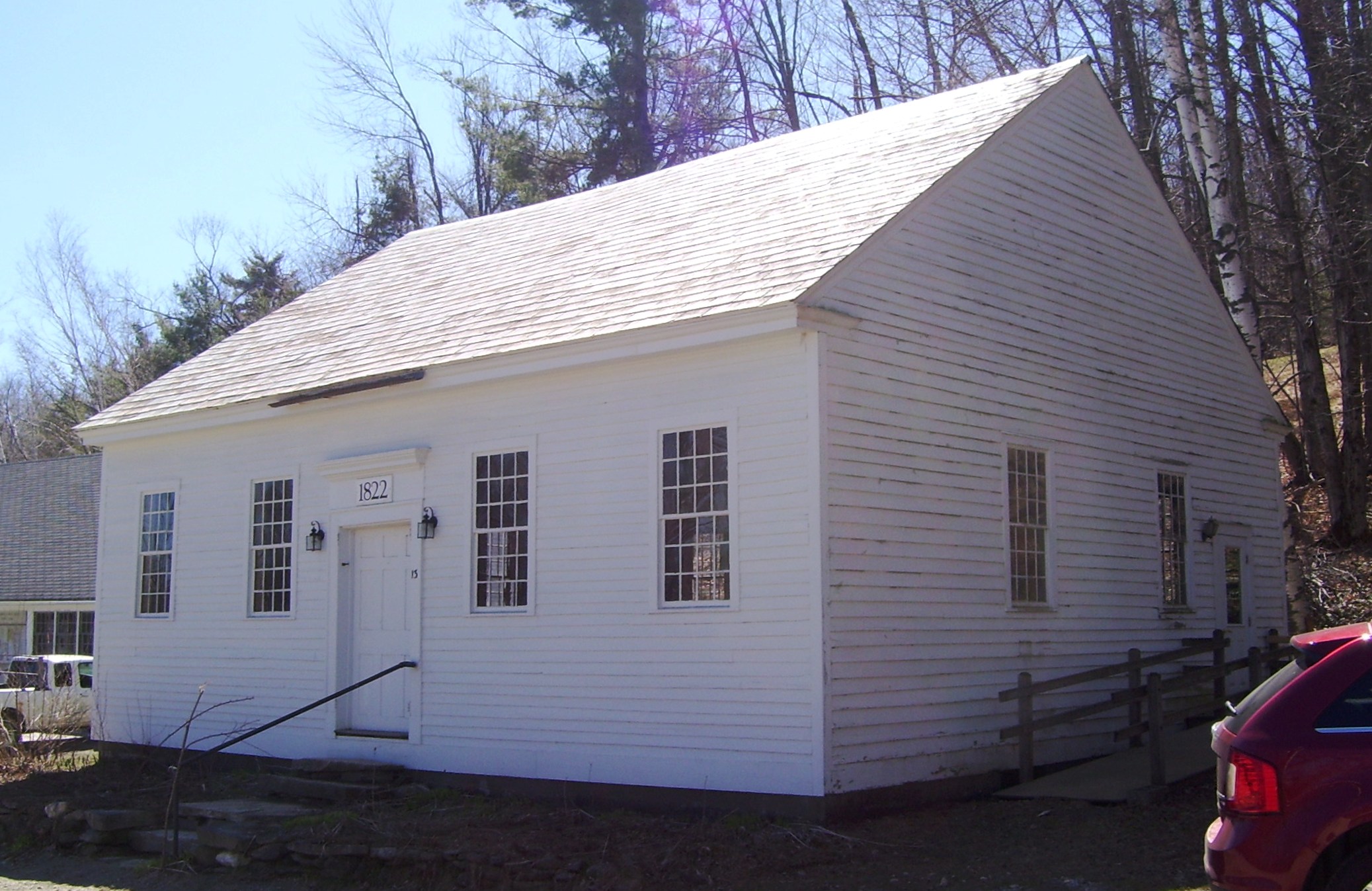
| Description | The Town House on South Road in Marlboro, Vermont , was built in 1822 and is used for Town Meetings. The building was originally built from timbers and boards salvaged from the town's first church when it was replaced with a newer structure, and stood near the church at the top of Town Hill. Both buildings were moved to South Road between 1836 and 1844, although the Town House was on the east side of the road until 1966, when a new, oversized snow plow hit it at that location, and it was moved to its current site. Despite its name, the nearby Meeting House Congregational Church was not used for Town Meetings. (Source: Forrest Holzapfel, Town Historian, April 2012 and Marlboro Historical Society website ) |
| Date | |
| Source | Own work |
| Author | Beyond My Ken |
| Camera location |
|
View this and other nearby images on: OpenStreetMap |
|
|---|
Licensing
I, the copyright holder of this work, hereby publish it under the following licenses:

|
Permission is granted to copy, distribute and/or modify this document under the terms of the GNU Free Documentation License , Version 1.2 or any later version published by the Free Software Foundation ; with no Invariant Sections, no Front-Cover Texts, and no Back-Cover Texts. A copy of the license is included in the section entitled GNU Free Documentation License . |
This file is licensed under the
Creative Commons
Attribution-Share Alike
4.0 International
,
3.0 Unported
,
2.5 Generic
,
2.0 Generic
and
1.0 Generic
license.
-
You are free:
- to share – to copy, distribute and transmit the work
- to remix – to adapt the work
-
Under the following conditions:
- attribution – You must give appropriate credit, provide a link to the license, and indicate if changes were made. You may do so in any reasonable manner, but not in any way that suggests the licensor endorses you or your use.
- share alike – If you remix, transform, or build upon the material, you must distribute your contributions under the same or compatible license as the original.
You may select the license of your choice.