MedwayM2OverRochesterChathamKingsnorth9936.JPG

Size of this preview:
800 × 600 pixels
.
Other resolutions:
320 × 240 pixels
|
640 × 480 pixels
|
1,024 × 768 pixels
|
1,280 × 960 pixels
|
2,016 × 1,512 pixels
.
Summary
| Description |
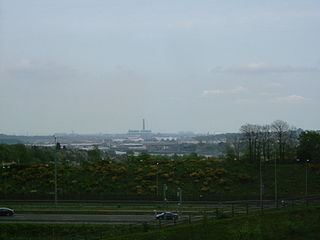
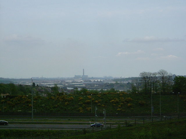
A view over Medway from Merrall's Shaw, Ranscombe Farm, Cuxton. In the foregrounfd is the M2 motorway, then there is Rochester Bridge , with the castle obscured by trees. The next roofs are those of the covered slips at Chatham Dockyard, then there is the power station at Kingsnorth, and behind and to the left the power stations at Grain, and the Thames estuary.
|
||||
| Date | |||||
| Source | Own work | ||||
| Author | ClemRutter |
Licensing
I, the copyright holder of this work, hereby publish it under the following licenses:

|
Permission is granted to copy, distribute and/or modify this document under the terms of the GNU Free Documentation License , Version 1.2 or any later version published by the Free Software Foundation ; with no Invariant Sections, no Front-Cover Texts, and no Back-Cover Texts. A copy of the license is included in the section entitled GNU Free Documentation License . |
|
|
This file is licensed under the Creative Commons Attribution-Share Alike 3.0 Unported license. | |
|
||
| This licensing tag was added to this file as part of the GFDL licensing update . |
This file is licensed under the
Creative Commons
Attribution 2.5 Generic
license.
-
You are free:
- to share – to copy, distribute and transmit the work
- to remix – to adapt the work
-
Under the following conditions:
- attribution – You must give appropriate credit, provide a link to the license, and indicate if changes were made. You may do so in any reasonable manner, but not in any way that suggests the licensor endorses you or your use.
You may select the license of your choice.