Mont_Carmel_1666.jpg
Size of this preview:
800 × 562 pixels
.
Other resolutions:
320 × 225 pixels
|
640 × 449 pixels
|
1,024 × 719 pixels
|
1,280 × 899 pixels
|
2,560 × 1,798 pixels
|
4,676 × 3,284 pixels
.
Summary
| Description |
English:
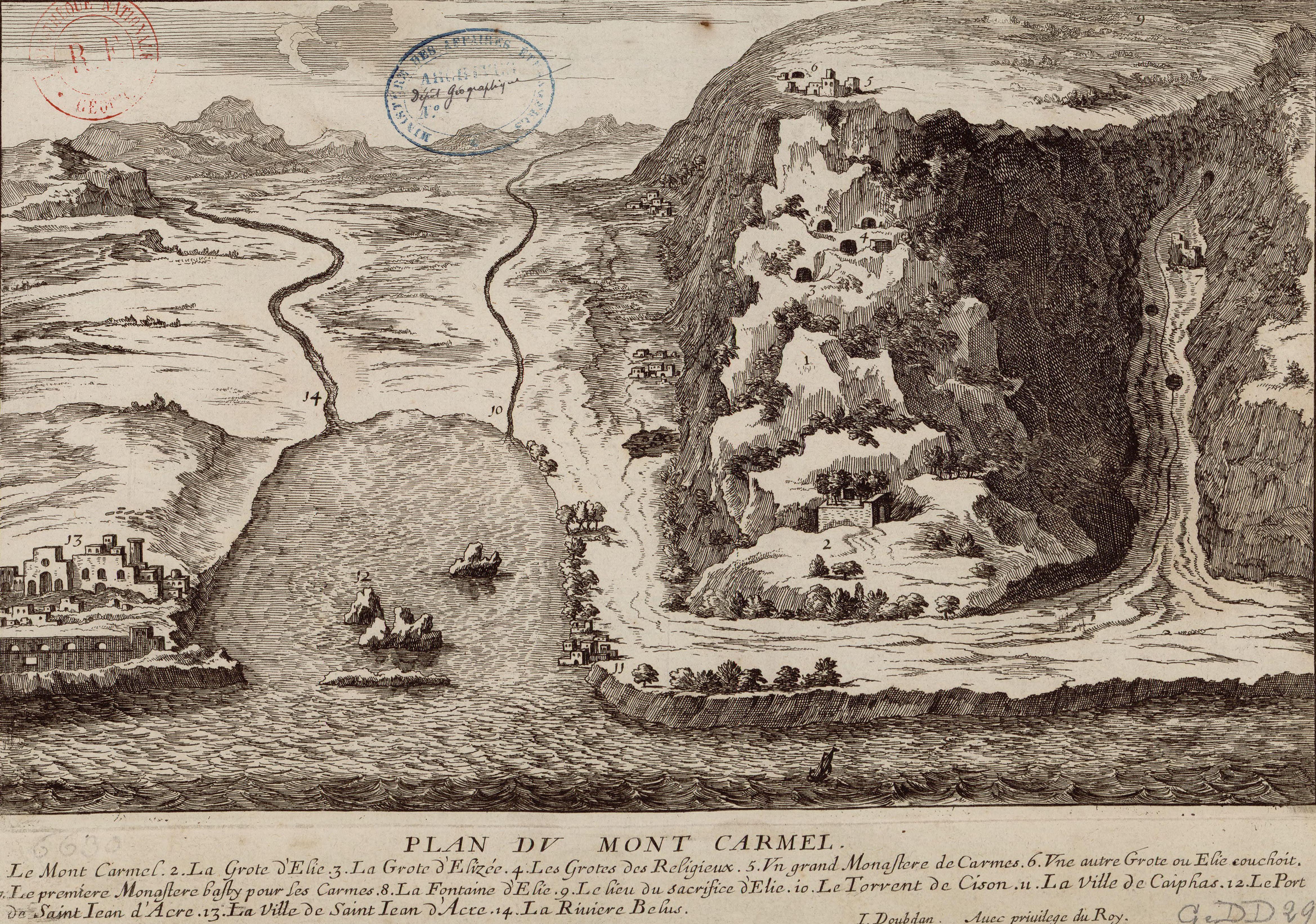
Doubdan, Jean. Le voyage de la Terre Sainte. Paris, 1666. beteween pp.490-1. 3rd edition of the book. First published in 1657. Plan du Mont Carmel [cartographic material] / I. Doubdan.
Français :
Plan du Mont Carmel. Vue en relief du Mont Carmel et de la baie d'Haïfa au XVII° siècle
|
| Date | |
| Source |
Bibliothèque nationale de France
|
| Author | Jean Doubdan. Le voyage de la Terre Sainte. Paris, 1666. beteween pp.490-1. 3rd edition of the book. First published in 1657. |
| Other versions |
Bibliothèque nationale de France
;
File:Plan du mont Carmel.jpg
|
Licensing
|
This is a faithful photographic reproduction of a two-dimensional,
public domain
work of art. The work of art itself is in the public domain for the following reason:
The official position taken by the Wikimedia Foundation is that "
faithful reproductions of two-dimensional public domain works of art are public domain
".
This photographic reproduction is therefore also considered to be in the public domain in the United States. In other jurisdictions, re-use of this content may be restricted; see Reuse of PD-Art photographs for details. |
||||