MtShasta_aerial.JPG

Size of this preview:
800 × 600 pixels
.
Other resolutions:
320 × 240 pixels
|
640 × 480 pixels
|
1,024 × 768 pixels
|
1,280 × 960 pixels
|
2,272 × 1,704 pixels
.
Summary
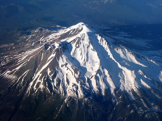
| Description | Aerial photo of Mount Shasta taken while flying from San Jose, California to Portland, Oregon |
| Date | Taken on 22 June 2006 |
| Source | Transferred from en.wikipedia to Commons by Hike395 . |
| Author | Ewen Denney ( talk · contribs ) |
Licensing
|
|
This file is licensed under the Creative Commons Attribution-Share Alike 3.0 Unported license. Subject to disclaimers . | |
|
||
| This licensing tag was added to this file as part of the GFDL licensing update . |

|
Permission is granted to copy, distribute and/or modify this document under the terms of the GNU Free Documentation License , Version 1.2 or any later version published by the Free Software Foundation ; with no Invariant Sections, no Front-Cover Texts, and no Back-Cover Texts. A copy of the license is included in the section entitled GNU Free Documentation License . Subject to disclaimers . |