NB_1866-1871.99.svg

Size of this PNG preview of this SVG file:
648 × 600 pixels
.
Other resolutions:
259 × 240 pixels
|
518 × 480 pixels
|
830 × 768 pixels
|
1,106 × 1,024 pixels
|
2,212 × 2,048 pixels
|
971 × 899 pixels
.
Summary
| Description |
English:
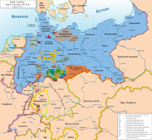
Map of North German Confederation 1866–1871
Deutsch:
Karte des Norddeutschen Bundes 1866–1871
|
||||||||
| Date | |||||||||
| Source | own drawing/Source of Information: Putzger – Historischer Weltatlas, 89. Auflage, 1965; Westermanns Großer Atlas zur Weltgeschichte, 1969; Haacks geographischer Atlas. VEB Hermann Haack Geographisch-Kartographische Anstalt, Gotha/Leipzig, 1. Auflage, 1979; dtv-Atlas zur Weltgeschichte Band 1: Von den Anfängen bis zur Französischen Revolution; 23. Aufl. 1989, ISBN 3-423-03002-X | ||||||||
| Author | Ziegelbrenner | ||||||||
|
Permission
( Reusing this file ) |
I, the copyright holder of this work, hereby publish it under the following licenses:
This file is licensed under the
Creative Commons
Attribution 2.5 Generic
license.
You may select the license of your choice.
|
||||||||
| Other versions | File:Norddeutscher Bund.png |
