NZL_orthographic_NaturalEarth_labelled_en.svg

Size of this PNG preview of this SVG file:
553 × 553 pixels
.
Other resolutions:
240 × 240 pixels
|
480 × 480 pixels
|
768 × 768 pixels
|
1,024 × 1,024 pixels
|
2,048 × 2,048 pixels
.
Summary
| Description |
English:
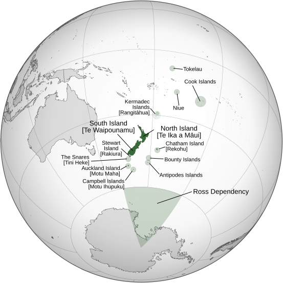
A map of the hemisphere centred on Wellington, New Zealand, using an orthographic projection, created using
gringer
's
Perl script
with
Natural Earth Data
(1:50000 resolution, simplified to 0.25px) and
LINZ Data
. New Zealand is highlighted in green. This map has been additionally annotated with Māori and English names for islands within the
Realm of New Zealand
.
|
| Date | |
| Source | Own work |
| Author | Gringer |
| Other versions |
[
]
|


Licensing
I, the copyright holder of this work, hereby publish it under the following license:
|
|
This file is made available under the Creative Commons CC0 1.0 Universal Public Domain Dedication . |
|
The person who associated a work with this deed has dedicated the work to the
public domain
by waiving all of their rights to the work worldwide under copyright law, including all related and neighboring rights, to the extent allowed by law. You can copy, modify, distribute and perform the work, even for commercial purposes, all without asking permission.
|