National_Geographic_map_of_Korea_and_Japan,_1945.jpg
Size of this preview:
800 × 569 pixels
.
Other resolutions:
320 × 227 pixels
|
640 × 455 pixels
|
1,024 × 728 pixels
|
1,280 × 910 pixels
|
2,560 × 1,820 pixels
|
5,339 × 3,795 pixels
.
Summary
| Description |
English:
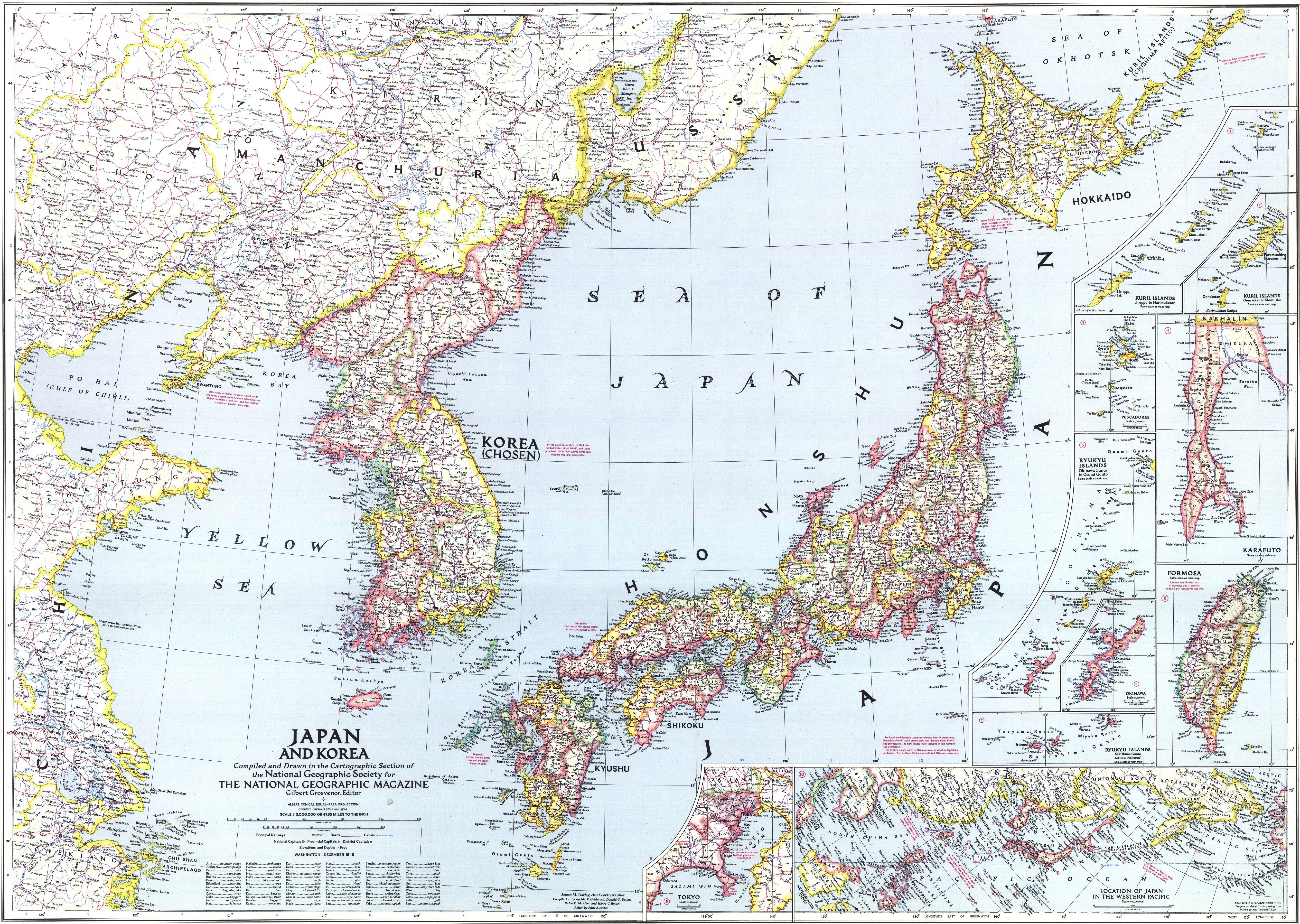
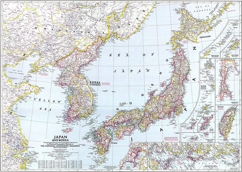
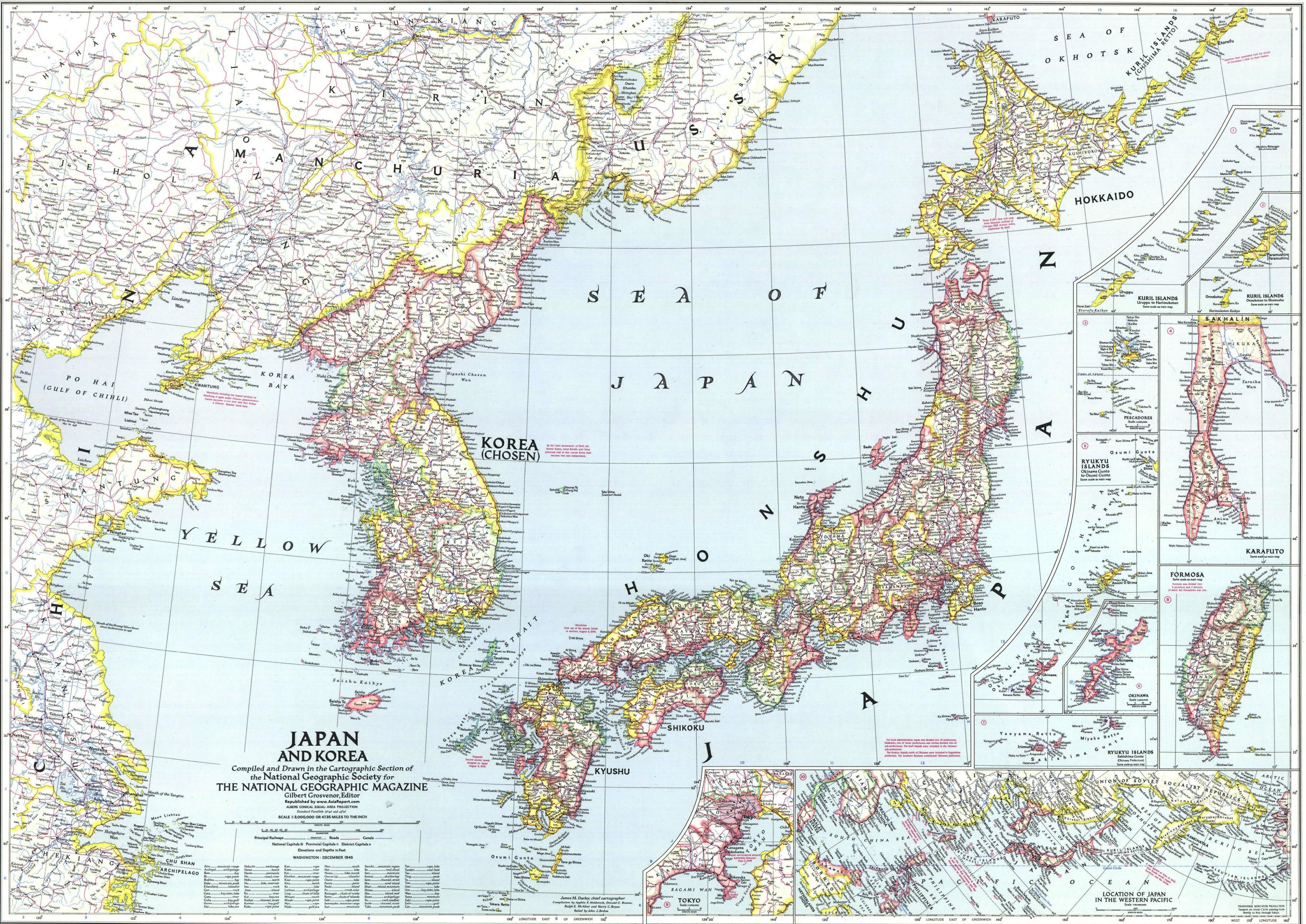
National Geographic map of Korea and Japan, 1945. This map reflects ROC's claim around Paektu Mountain. This map does not reflect de facto Sino-Korean border in 1945.
|
| Date | |
| Source | http://www.drben.net/publishImages/Koreas_Report~Sources~Korea_Maps~Historic~1945~Map-Japan-Korea-1945-01~~element1972.jpg |
| Author | National Geographic |
Licensing
|
|
This work is in the
public domain
because it was published in the United States between 1929 and 1963, and although there may or may not have been a copyright notice, the
copyright was not renewed
. For further explanation, see
Commons:Hirtle chart
and
the copyright renewal logs
. Note that it may still be copyrighted in jurisdictions that do not apply the
rule of the shorter term
for US works (depending on the date of the author's death), such as Canada (70 years
p.m.a.
), Mainland China (50 years p.m.a., not Hong Kong or Macao), Germany (70 years p.m.a.), Mexico (100 years p.m.a.), Switzerland (70 years p.m.a.), and other countries with individual treaties.
|

|