Needle_Rock_at_the_Storr_-_geograph.org.uk_-_779845.jpg
No higher resolution available.
Summary
| Description |
English:
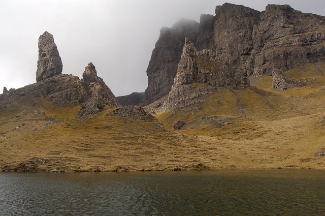
Needle Rock at the Storr. The needle rock is the big pinnacle just right of centre, sitting below the cliffs of the Storr itself. The pinnacle on the left is the Old Man of Storr, in
NG5053
. The water in the foreground is part of
779855
, trapped in a hollow in the extreme landslip terrain.
|
| Date | |
| Source | From geograph.org.uk |
| Author | John Allan |
|
Attribution
( required by the license ) |
John Allan / Needle Rock at the Storr / |
| Camera location |
|
View this and other nearby images on: OpenStreetMap |
|
|---|
_heading:247.00&language=en)
| Object location |
|
View this and other nearby images on: OpenStreetMap |
|
|---|
_heading:247.00&language=en)
Licensing

|
This image was taken from the
Geograph project
collection. See
this photograph's page
on the Geograph website for the photographer's contact details. The copyright on this image is owned by
John Allan
and is licensed for reuse under the
Creative Commons
Attribution-ShareAlike 2.0 license.
|
This file is licensed under the
Creative Commons
Attribution-Share Alike 2.0 Generic
license.
Attribution:
John Allan
-
You are free:
- to share – to copy, distribute and transmit the work
- to remix – to adapt the work
-
Under the following conditions:
- attribution – You must give appropriate credit, provide a link to the license, and indicate if changes were made. You may do so in any reasonable manner, but not in any way that suggests the licensor endorses you or your use.
- share alike – If you remix, transform, or build upon the material, you must distribute your contributions under the same or compatible license as the original.