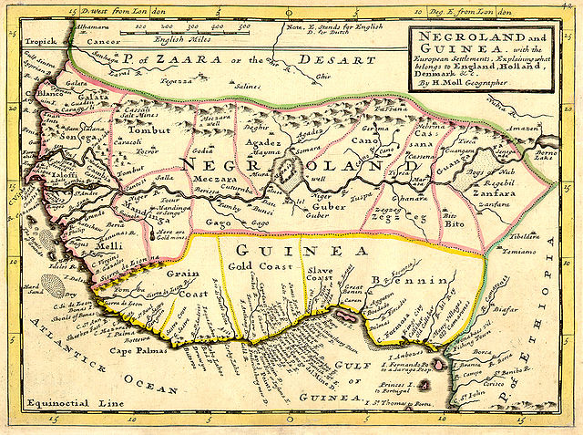
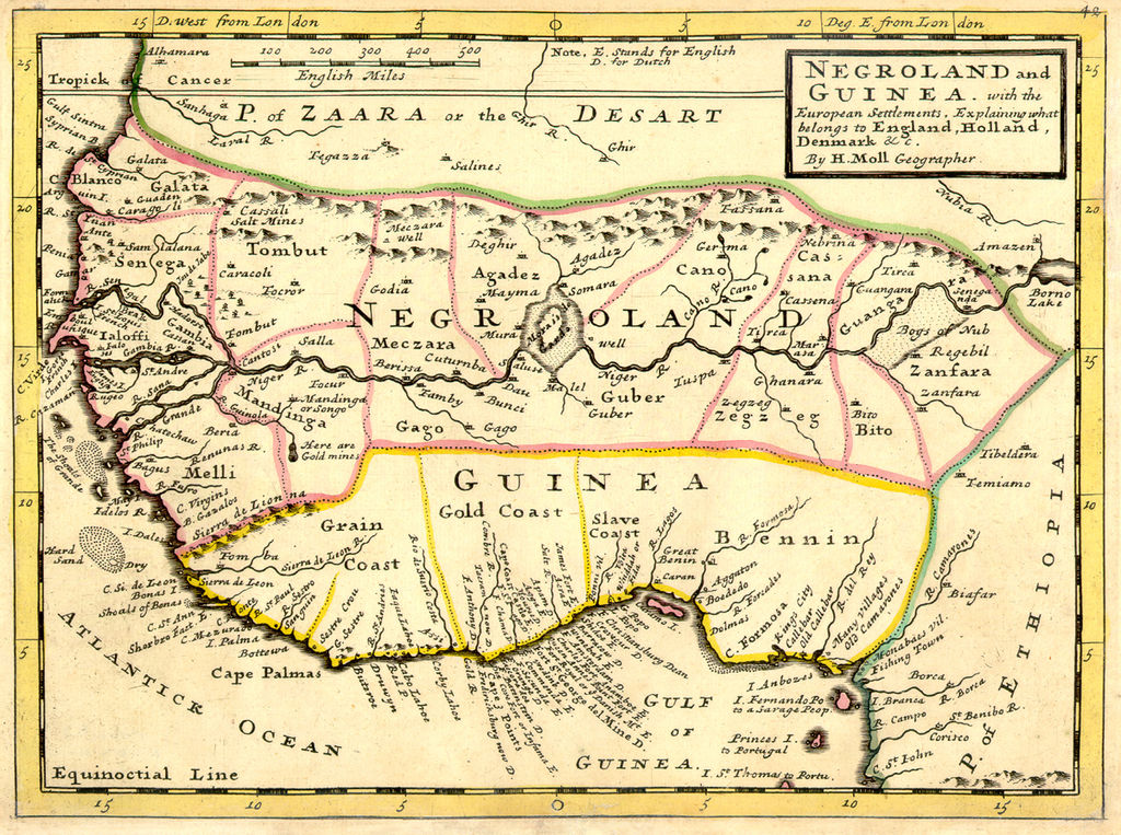
Negroland_and_Guinea_with_the_European_Settlements,_1736.jpg

Size of this preview:
800 × 596 pixels
.
Other resolutions:
320 × 238 pixels
|
640 × 477 pixels
|
1,024 × 763 pixels
|
1,200 × 894 pixels
.
Map|thumb|alt= https://www.canva.com/design/DAEqyLnPwRY/share/preview?token=KSHUFcVdAgta6UUstYCF7w&role=EDITOR&utm_content=DAEqyLnPwRY&utm_campaign=designshare&utm_medium=link&utm_source=sharebutton%7CThis 1747 Map reflects the various Kingdoms. The Kingdom of Juda(h). Ouidah /ˈwiːdə/, also Whydah /ˈhwaɪdə/ ]]
Summary
| Description | Full title: 'Negroland and Guinea with the European Settlements, Explaining what belongs to England, Holland, Denmark, etc'. By H. Moll Geographer (Printed and sold by T. Bowles next ye Chapter House in St. Pauls Church yard, & I. Bowles at ye Black Horse in Cornhill, 1729, orig. published in 1727). [1] |
| Date | |
| Source | University of Florida, George A. Smathers Libraries, historic African maps : 1729 Herman Moll (# ALW1663 ) |
| Author | Herman Moll |
Licensing
|
|
This work is in the public domain in its country of origin and other countries and areas where the copyright term is the author's life plus 100 years or fewer . |
| This file has been identified as being free of known restrictions under copyright law, including all related and neighboring rights. | |
Original upload log
(All user names refer to en.wikipedia)
- 2006-06-13 23:18 LIL T 1200×894×8 (1624023 bytes)