New_Orleans_Section_and_West_Bank_1998_Map.jpg
Size of this preview:
519 × 599 pixels
.
Other resolutions:
208 × 240 pixels
|
416 × 480 pixels
|
665 × 768 pixels
|
887 × 1,024 pixels
|
1,774 × 2,048 pixels
|
3,899 × 4,500 pixels
.
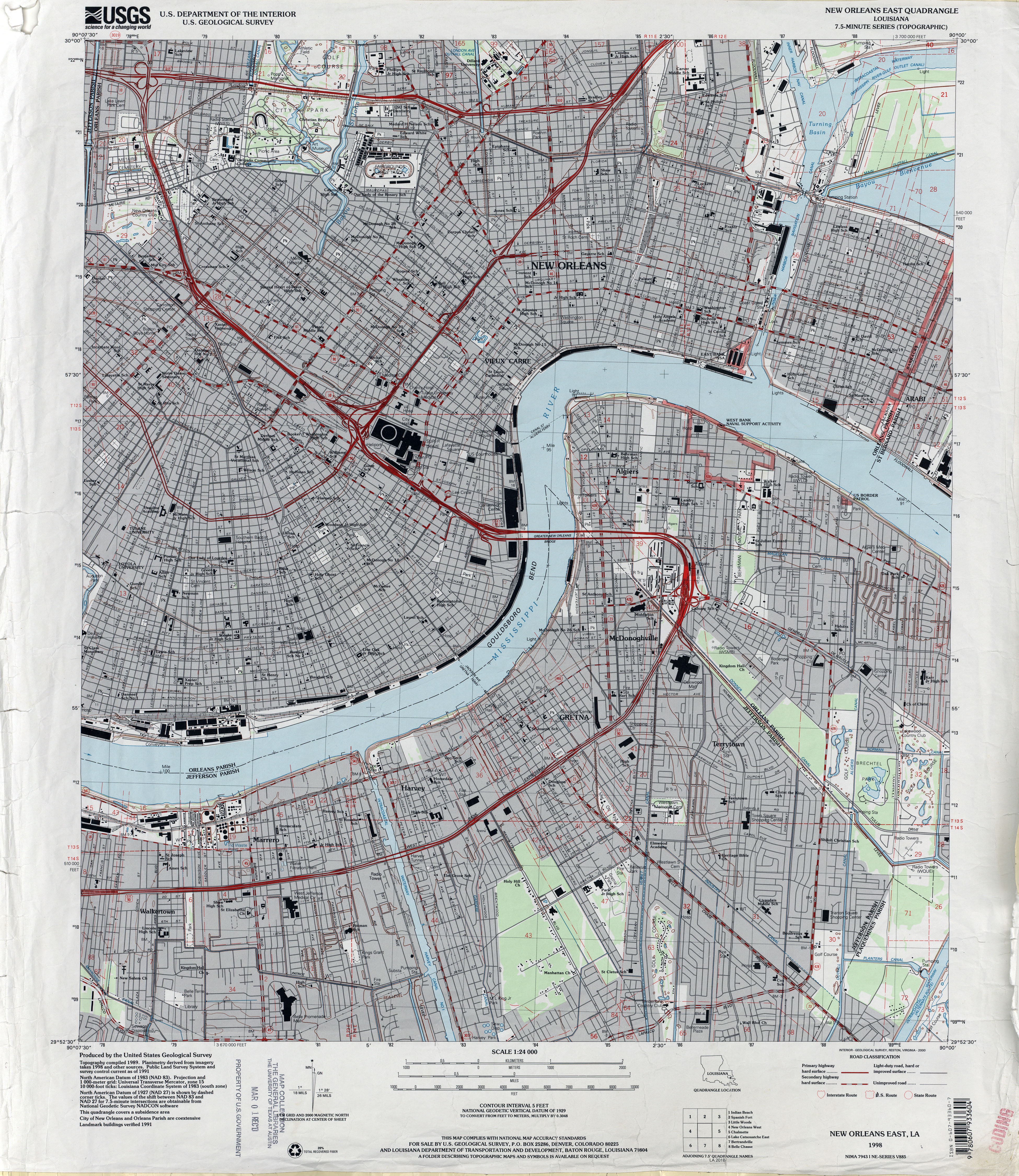
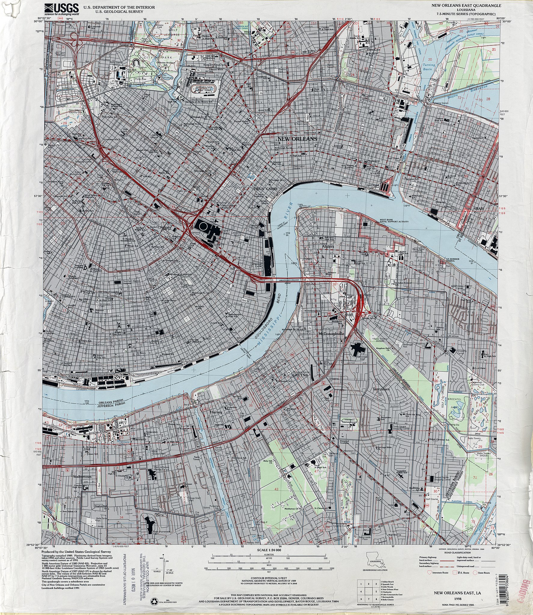
| Description | 1998 map of New Orleans, showing the section of the city closer to the Mississippi River, from about Mid-City to just below Audubon Park to the Lower 9th Ward, together with Algiers and the West Bank Jefferson Parish suburbs including Marrero, Harvey, Gretna. | |||
| Date | ||||
| Source | U.S. Geological Survey map, 1998, via [1] | |||
| Author | U.S. Geological Survey | |||
|
Permission
( Reusing this file ) |
|