Nordkalotten.JPG
No higher resolution available.
Summary
| Description |
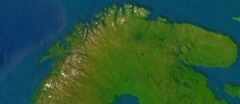
English:
Satellite image of the
Cap of the North
.
Svenska:
Satellitbild av
Nordkalotten
.
|
| Date | 11 November 2006 (original upload date) |
| Source | NASA WorldWind |
| Author | NASA |

Licensing
|
|
I, the copyright holder of this work, release this work into the
public domain
. This applies worldwide.
In some countries this may not be legally possible; if so: I grant anyone the right to use this work for any purpose , without any conditions, unless such conditions are required by law. |