Northern_and_Southern_Ireland.png
No higher resolution available.

|
This
historical map
image could be re-created
using
vector graphics
as an
SVG
file
. This has several advantages; see
Commons:Media for cleanup
for more information. If an SVG form of this image is available, please upload it and afterwards replace this template with
{{

vector version available

|

new image name

}}
.
It is recommended to name the SVG file “Northern and Southern Ireland.svg”—then the template Vector version available (or Vva ) does not need the new image name parameter. |
Summary
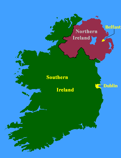
from english wikipedia (21:56, 15 August 2005 . . JW1805 . . 415x541 (14825 bytes)) Map of Northern Ireland and Southern Ireland, created by the Government of Ireland Act, 1920
Licensing

|
The
copyright holder
of this work allows anyone to use it
for any purpose
including unrestricted redistribution, commercial use, and modification.
Usage notes:
|