Notre_Dame_de_Chartres.jpg
Size of this preview:
786 × 600 pixels
.
Other resolutions:
315 × 240 pixels
|
629 × 480 pixels
|
1,006 × 768 pixels
|
1,280 × 977 pixels
|
2,437 × 1,860 pixels
.
Summary
| Description |
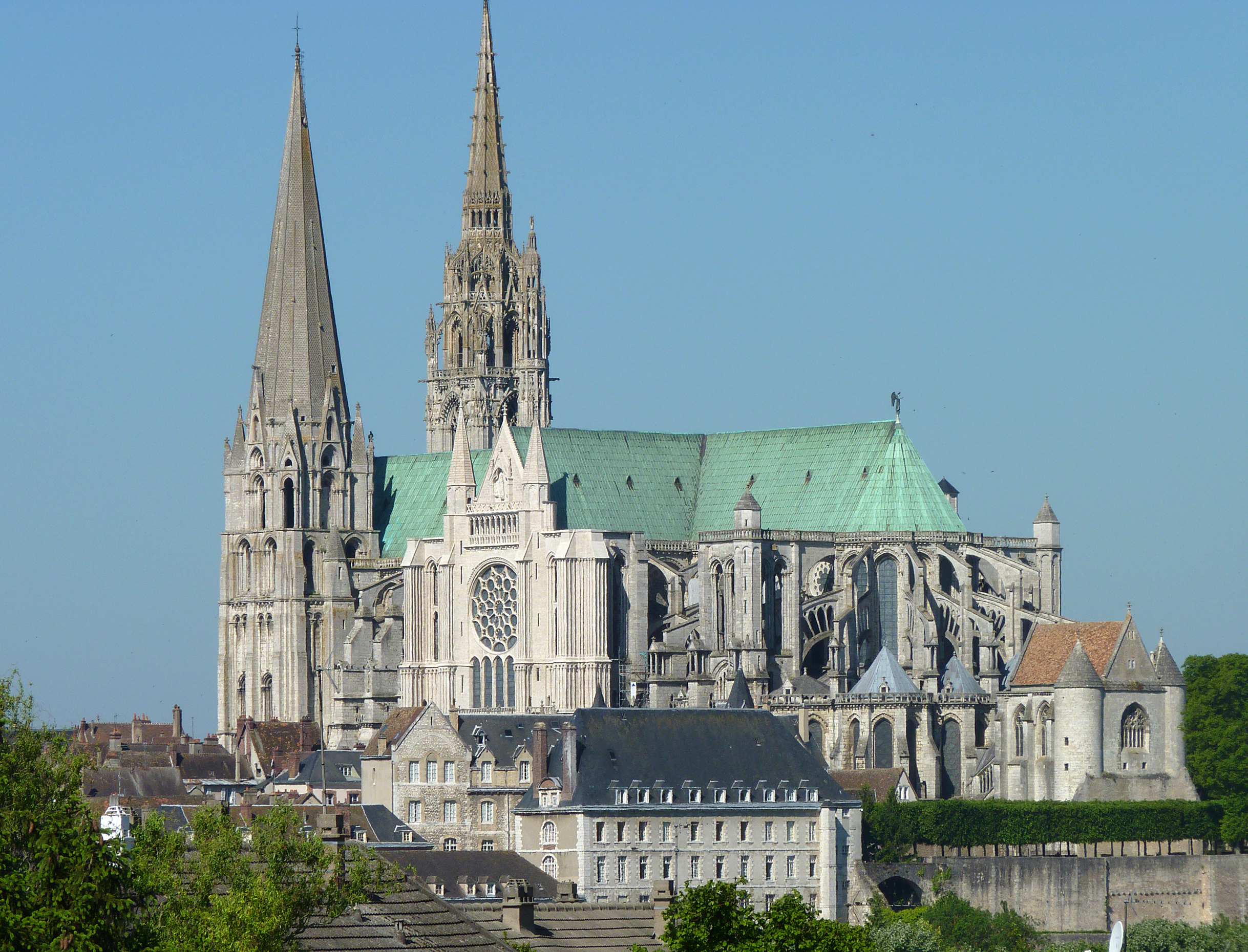
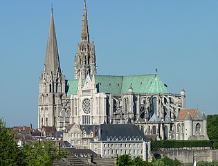
English:
Chartres Cathedral
, High Gothic - view from south-east
Français :
vue portail sud
עברית:
מבט מדרום-מזרח על קתדרלת שארטר הגותית
|
| Date | |
| Source | Own work |
| Author | Olvr |
| Object location |
|
View this and other nearby images on: OpenStreetMap |
|
|---|
Licensing
I, the copyright holder of this work, hereby publish it under the following license:
This file is licensed under the
Creative Commons
Attribution-Share Alike 3.0 Unported
license.
-
You are free:
- to share – to copy, distribute and transmit the work
- to remix – to adapt the work
-
Under the following conditions:
- attribution – You must give appropriate credit, provide a link to the license, and indicate if changes were made. You may do so in any reasonable manner, but not in any way that suggests the licensor endorses you or your use.
- share alike – If you remix, transform, or build upon the material, you must distribute your contributions under the same or compatible license as the original.

|
This image was uploaded as part of
Wiki Loves Monuments 2011
.
|
|
|
|
This building is
classé au titre des
monuments historiques de la France
. It is indexed in the
base Mérimée
, a database of architectural heritage maintained by the
French Ministry of Culture
, under the reference
PA00096993
|