Nubia_NASA-WW_places_german.jpg
Size of this preview:
391 × 600 pixels
.
Other resolutions:
156 × 240 pixels
|
472 × 724 pixels
.
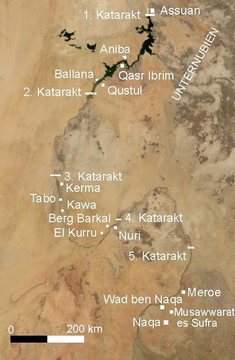
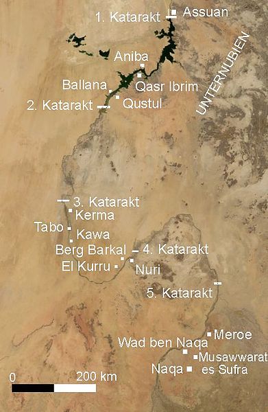
Deutsch:
Nubien mit Orten in deutscher Sprache - Satellitenbild erstellt mit Nasa World Wind
English:
Map of Ancient Nubia
over-layed on satellite picture, with ancient placenames (in german).
- Satellite image created with Nasa World Wind , of present day southern Egypt and northern Sudan .
Summary
taken from de.wiki there under PD-WorldWind with description:
| Description |
Summary
|
|||
| Date | 19 April 2006, 01:24:35 (upload date) | |||
| Source | Originally from de.wikipedia ; description page is (was) here | |||
| Author | User Udimu on de.wikipedia | |||
|
Permission
( Reusing this file ) |
|
