Nuremberg_network_map.png
Size of this preview:
800 × 541 pixels
.
Other resolutions:
320 × 216 pixels
|
640 × 433 pixels
|
1,024 × 693 pixels
|
1,280 × 866 pixels
|
2,560 × 1,732 pixels
|
4,964 × 3,358 pixels
.
Summary
| Description |
English:
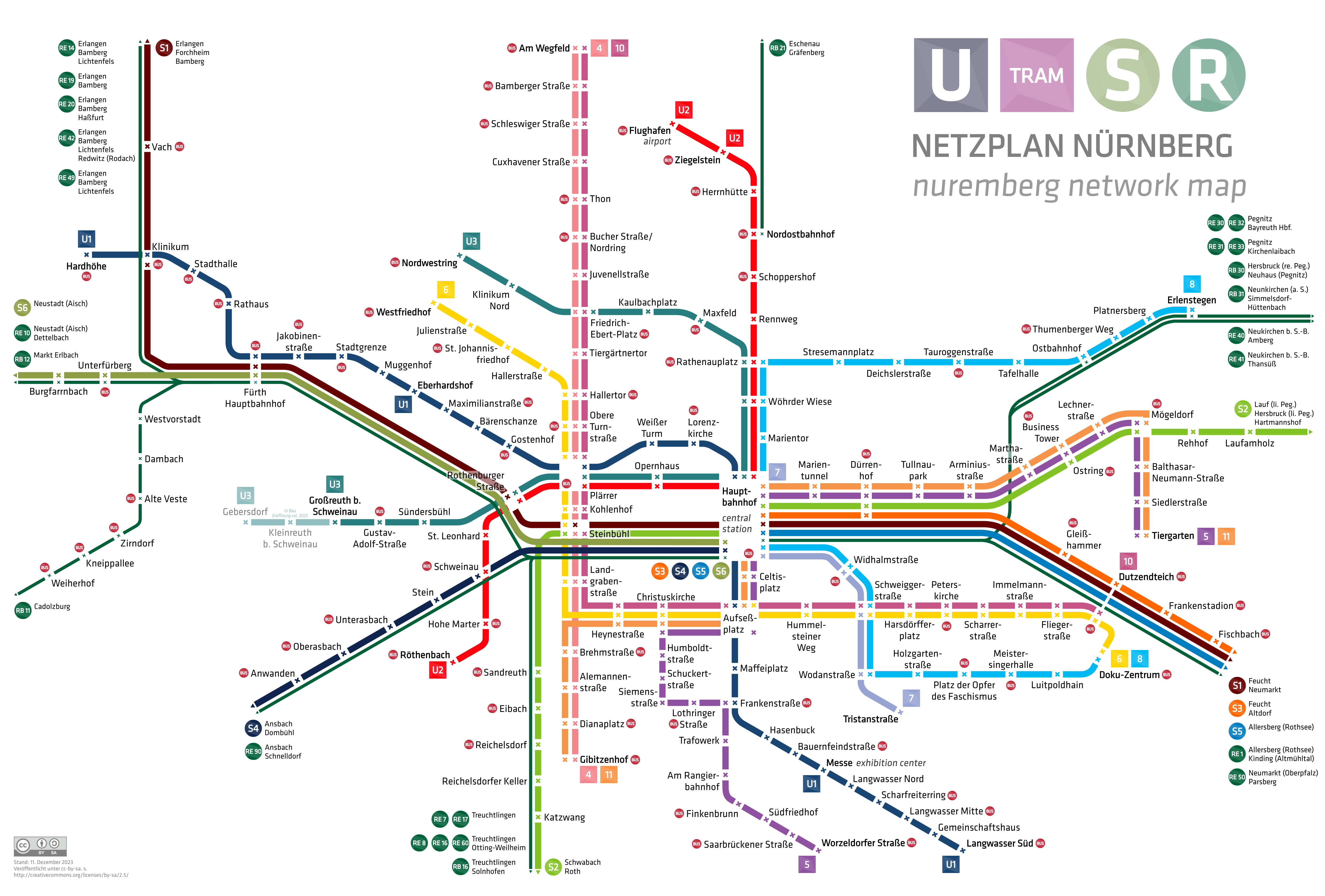
nuremberg city network map with underground, tramway, suburban railway and regional railway
|
| Date | |
| Source | Own work |
| Author | HerrMay |
Licensing
I, the copyright holder of this work, hereby publish it under the following license:
|
|
This file is made available under the Creative Commons CC0 1.0 Universal Public Domain Dedication . |
|
The person who associated a work with this deed has dedicated the work to the
public domain
by waiving all of their rights to the work worldwide under copyright law, including all related and neighboring rights, to the extent allowed by law. You can copy, modify, distribute and perform the work, even for commercial purposes, all without asking permission.
|